Tuesday, June 12, 2018

# 2 Moses Lake to Bonners Ferry


June 5, 2018

Before leaving the RV Park we visited with our neighbors.   The couple just recently retired and entered the RV life style to avoid the summer heat of their Scottsdale, AZ home. Fortunately several family members live in the northern latitudes and provide them with destinations.


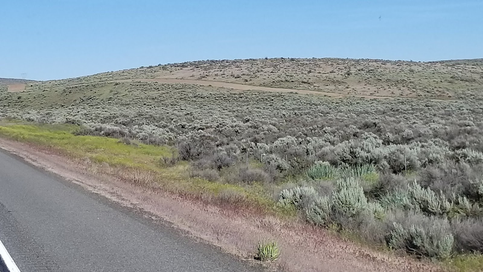
 The road east encompasses miles and miles of mostly flat land rolling across some bumps and small mounds in the terrain.


Some mounds display exposed rock eroded by the seasons of time.


 Acres of sagebrush make a patchwork quilt with acres of farm land.  Some fields look like wheat, hay, potatoes or canola.  Some fields are left to the grasses this year.


Here and there silos rise from the flat surface. Black cattle graze in the green grassy pastures.

 Trains trudge across the landscape carrying their products to market.


 Farms sit on the little hills whiles black cattle seek tender green morsels in the pastures.


I missed a photo opt!  While driving through miles of sagebrush a deserted looking structure appears. A HUGE sign greets oncoming traffic.  In the past it might have read: EATS or GAS.  Today it read: CANNIBIS, and caused me to chuckle.


 Just before Sprague we passed an interesting campground sitting right on the shores of Sprague Lake. The Four Seasons Campground didn’t look fancy, just quiet and nice.  It may be for sale, but we saw rigs parked there. 509-257-2332 if you want to check it out.


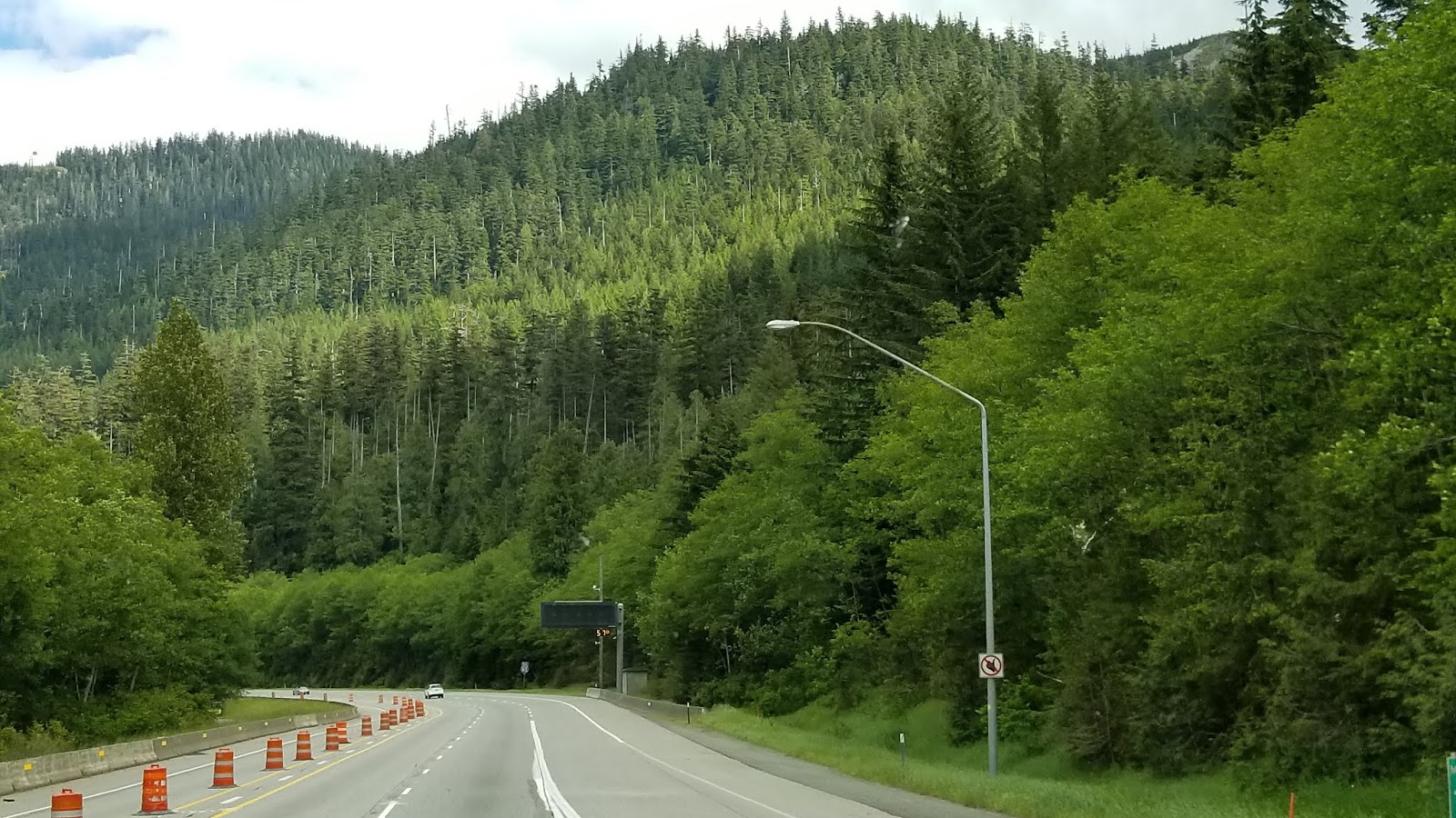
Eastbound I-90 fills the slopes with mostly fir and cedar trees on the West side of the mountains.  On the east side of the mountains pine trees and deciduous trees fill the area.  The closer we got to Spokane pine trees grew in abundant groves. I had forgotten how many lakes , ponds and little rivers occur in 
Eastern Washington. 

The pines reminded me of Spokane where I spent the first 8 years of life.   I did so much gawking as we passed Spokane I forgot to take photos.

However.....if you are in the market for an RV, I suggest taking a trip to Spokane.  The east side of Spokane, looming along I-90 sit acres of every kind of vehicle that might tickle your fancy!


Hello Idaho!    

We chose to stop in Post Falls, Idaho and top off all our fuel before entering Canada.  Diesel was available farther north, but not DEF.  DEF stands for Diesel Exhaust Fluid….I think.  It is an additive that cleans the exhaust and helps the environment.  It is now on the newer RVs.  The fuel stops in Bonners Ferry only have DEF in bottles and we prefer to pump it at a truck stop. So we stopped in Post Falls and filled up on diesel, DEF and propane.   Canada here we come!


 Northern Idaho emits a serene, rural feeling.  Pine trees cover the hills and line the highway. 


 Many lakes and water ways sit close to the highway. You come around a bend and there sits some gorgeous homes perched either above or peacefully right on the lake shore.  The lakes are surrounded by trees.


Lake Cocolalla is another example of houses on lakes.


Farms and ranches open the land to crops and cattle between sections of forest.


Trains tracks follow the highway north.  We heard them from where we camped later. We know when camping in Canada, the parks are never far from tracks.


We entered Sandpoint, Idaho via a long bridge or causeway. The town sits where the Pend Oreille River meets the Pend Oreille Lake.


A train passed by across the Pend Oreille Lake.  The bridge coming at us across the water supports the trains coming into Sandpoint.


We followed a school bus from Post Falls all the way to where it exited in Sandpoint…a distance of 50 miles.  Sandpoint looks like an interesting place to visit. The train depot caught my eye.  If we had the time, Sandpoint beckoned to further investigation.  Silverwood Amusement park looked inviting as we drove by.  We did notice several school buses in their parking lot.
 We continued northward and arrived in Bonner’s Ferry. Suddenly we realize that we missed the turnoff to the RV Park where we made reservations.  The park is actually listed in Bonners Ferry, but has a Naples address. So we found a place to turn around and drove nine miles south over the road we had just traveled.  Road signage exists, but you need to look for it carefully and quickly.  So happy to have Google Maps!  We found the road, slowed to turn and we see the ROAD CLOSED sign.  A railroad crew was fixing the tracks and the intersection we needed to cross.  We could wait until 5 pm for the road to open, but it was just about 3 now.  We opted to change plans.  We drove south until we could turn around again…..not a lot of turn arounds spaces big enough for us on this rural road. We cancelled our reservation and let them know we couldn’t get there.  Meanwhile I’m searching for another park. 


Found one!  Just south of the Canadian border!
Idyl Acres Campground!  However: no Wi-Fi, no cell phones, no computer, no satellite and thus no Google Maps. 


 No need for a reservation, we will be the only ones in the park.  

A little old couple, 88 and 90 years old, own and run this park.  They are both a little deaf and her eyesight is going.


This park sat out into this little lake.  We could walk down to the shore and enjoy the view.


We found this to be a pretty little place, where birds chirp, Aspen leaves flutter and the quiet is only interrupted by the occasional highway noise, or the trains in the distance. If you need to "unplug" this is the place!

Two days on the road and two hiccups in planning.  Hope this isn’t a trend.  Today’s change may create another change tomorrow.  Each one adds to the adventure.

RV rule#1:  Stuff happens!   Laugh, deal with it and go on to whatever awaits you next!


Saturday, June 9, 2018

#1 Bremerton to Moses Lake


 Blog #1    Bremerton to Moses Lake:
The rig is loaded. The plans are made.  The adventure begins!  We are headed for Newfoundland! 
 The itinerary shows a departure date from Bremerton on June 4, 2018 and a return to Chula Vista, CA on November 20, 2018. We enter British Columbia, Canada via Idaho.   Then travel across Canada with some stops along the way until we get to Nova Scotia. There we travel by a HUGE ferry to Newfoundland.  After exploring the island for 2 months, we will continue down the east coast of the states to Georgia before coming back across the south to California.
Disclaimer:  many of my photos will be taken either with my phone or camera, out of the window as we head for our destinations.  Quality may be affected by speed of travel and the amount of bugs on the windshield.  I expect photos taken at each destination to be remarkable better.
Launch Day 1: 
For those of you who do not know me well, I am preferably…. a do-not-do-mornings person.  I enjoying rising about 9 am and heading off to exercise.   However, I can rise earlier if necessary.   We planned a Monday, mid-morning departure for this adventure.  Then I got the call back for my mammogram. We left about 8 am for my 8:30 appointment thinking it would be quick. Wrong. The exam showed the need for a biopsy.  Bless Harrison Imaging! Knowing we were ready to embark on a six month trip, the staff quickly arranged for an immediate biopsy procedure.   We were home by 1 pm, ate, packed up and were on the road before 2 pm.   Hiccup #1.....A 5 hour imaging appointment was not part of today’s itinerary.

Oh well…..Stuff happens!
We made good time getting to I-5 only to hit pre-rush hour traffic. Hanging out in Phoenix, San Diego and Portland teaches travelers to avoid freeways between 3 pm and 7 pm if possible. The traffic gave us time to look around and realize we haven’t traveled this stretch of I-5 in about 8 years.  We slowed down through Auburn and Kent. 


As we began our climb up the Cascade Range toward Snoqualmie Summit the traffic fell away with the cities.  Tall and stately fir and pine trees covered the hills and lined both sides of the highway.  Waterfalls cascaded down the mountain sides.  


Patches of snow dotted the tops of the highest peaks.   The ski resorts of Snoqualmie sported grassy slopes this June day.   


Keechelus Lake east of the summit appeared completely full.  We have seen it decimated in the past with stumps rising out of the low water levels. Today gentle waves lapped the edges under the cloud covered sky.

Road construction was underway right on the banks of the lake. The massive project shows an additional 2-3 lane highway under construction. High above the new road, two lanes travel west, and another two lanes travel east.  Eastbound travelers can look directly down at the new road.


Descending the eastern slopes of the Cascades two things become obvious, the sun is out and the temperature has risen four degrees to a warm 64 degrees.  Wind farms stretch across the farmland.


The road follows the Yakima River as it meanders toward Ellensburg.   Signs alert drivers to free range livestock who may wander onto the road.  Some cattle remain in fenced pastures.  


Around Ellensburg, now 68 degrees, I noted the use of hay tents.  These plastic tents, many red and white stripes, look like little barns. In the past hay was shrink-wrapped into cylinders.  We saw some of those, but the tent structures were more popular in this area.


 We saw fields of freshly mowed hay and some that had been baled but not collected.   The collected hay bales were then placed in tents of varying sizes.


 In some areas the hills appear barren, but the field are irrigated and green. 


Herds of cattle munch lazily in the pastures, under the blue cloudless sky and bright sun. 


This railroad trestle  stood out against that bright blue sky


An abundance of wind farms use their giant rotor arms to change the wind into electricity.  I found it difficult to photograph with any perspective on their actual size. You may be able to see vehicles just below a windmill.   We have seen a single rotor arm being transported on an extra-long semi-truck. The wind farms fascinate me as the turn consistently on the mountain tops.


Their windmills stand like sentries on the sagebrush landscape. I find it interesting that this area not only support wind power, but also hydroelectric power produced at Grand Coulee Day and other dams along the river.


The highway descends for 10 miles at a 4% downgrade toward the little town of Vantage (temperature now 73 degrees) and the Mighty Columbia River.  


To my friends in Arizona, this is what a river looks like!  The Columbia River cuts through Washington State north to south. Then it turns west on its way to the Pacific Ocean, forming the boundary between Washington and Oregon.


If the pioneers of the mid 1800s knew then what we know now, the western halves of Washington and Oregon would be the west state, and the eastern halves of Washington and Oregon would  have been another state.
Then each state could deal with common issues.


As the highway crosses the bridge the road rises quickly in elevation.  Stark and stoic rock outcroppings tower over the highway.  


The Columbia Gorge can be viewed easier from the west bound lanes, but I got only a quick peek or two as we climbed the grade. 


The farms of Central Washington show strong signs of spring.  The vineyards of Central Washington are well thought of, and many people make an annual trip here in the fall to purchase Washington Wines.


Some farms have irrigation and gigantic sprinklers watering their crops.  This part of Washington looks a lot like the farming areas along Highway 101 in Northern California. Sometimes their spray made small rainbows as we passed. 


We crossed the Columbia, and traveled to Moses Lake where we spent the night in the Suncrest RV Park just off Hansen Road.  Very nice...clean, neat, pool, and other amenities.