#5 Le Duc to The Battlefords 6/10/18
The rain pounded against the roof this
Sunday morning and the wind blew hard.
The storm continued through the night.
Derrille awoke to a “different” sound. When you live in an RV, being
alert to “different sounds” becomes a necessity. Derrille identified the sound as a drip,
drip, drip. He found water dripping out of our AC vent and soaking the bottom
corner of the comforter. Hmmm ….What to
do??? We called our friends the Corras. Their son, Jordan, happens to be a RV tech.


Bless Jordan!
He came right out on this Sunday morning,
and climbed on top of the rig in the rain and wind!
It appears that the men who installed our
new air conditioner did not seal it correctly.
The high winds and heavy rain caused it to buckle a bit, letting it rain
inside. Jordan gave us a Band-Aid repair
that will hold until we can get it properly fixed. Thank You, Jordan!


Also thanks to Joe, for offering his tools, and moral support to our problem on this rainy blustery day. Notice the flag flying full out and the bending trees.


This RV park sits right on the flight path
of the airport. Planes fly low over the
rig and it feel like it is right on top of you.
Good to go, we headed north toward
Edmonton. The Anthony Henday Highway
(216) took us around Edmonton and connected us to the Yellowhead Trail
(Trans-Canada 16). I thought I got the photos of those sign, but apparently not. As we went east out
of town, we noticed several RV storage lots. The wind continued to blow and the
rain sprinkled on and off.
A ways out of town, we passed the Ukrainian
Cultural Village. School buses dot the
parking lots. If I had been aware of
this place, we would have planned to stop.


The prairies continued as before with ranch
houses, cattle, silos, never-ending fields, and flat straight roads. We have now traveled hundreds of miles on Canadian
roads with ZERO litter along the shoulders.
We find the cleanliness of Canadian roads to be most impressive.


In the small town of Vegreville we stopped
to see the Vegreville Pysanka. Our
friends had told us about the Pysanka, which is a big Ukrainian Easter Egg. The egg is located in an Elks Park. The Pysanka has existed from Pre-Christians
times as part of the Ukrainian traditions.
As Christianity was adopted, the Pysanka talismanic meanings were
blended with religious beliefs and seen in each egg’s design.

The color scheme, which is important, uses
bronze to represent Mother Earth, white for purity and innocence, and yellow
for prosperity. Each design also
symbolizes virtues.
The egg erected here symbolizes the culture
of the settlers here during the early twentieth century. It also symbolizes the
numerous ethno-cultural groups who developed this community. It celebrated the
centenary of the RCMP….Royal Canadian Mounted Police. 1874-1974

It took over 12,000 hours of design and
fabrication to develop the egg. It
measures: 25.7 feet long, 18.3 feet wide, and 31.0 feet at its
highest point from the ground. For
weight: the aluminum skin = 2000 lbs., internal structure = 3,000 lbs., and the
base =27,000 lbs.
Perhaps you can get more info from the
photo.

Check out the” Did you know photo.”
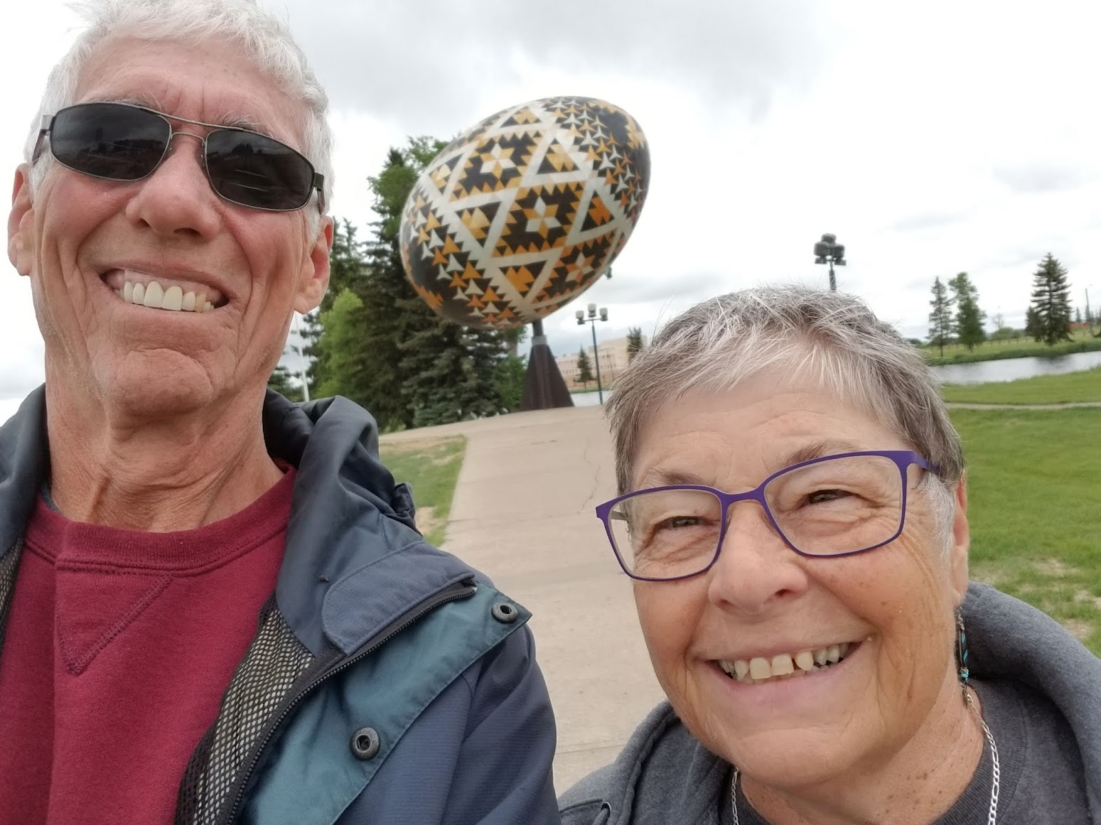
Here is our very first selfie!


This is an Elks Park with lots of plaques to honor other groups in town.

I liked this house sitting on the prairie facing the road.

Grain elevators show up often along the
road. Our waiter Erik will explain to us in a few days that farmers put the
grain they grow into their own silos. Then the grain is trucked to a terminal
like the Richardson Inland Terminal or the ILTA facilities. From there the grain is shipped by trains to
larger distribution centers and then on to whoever buys it. This is if I remember correctly.


This area has more cattle ranches.


I mentioned the roads in the last blog but
here are some more examples.


The roads are nearly perfectly straight,
unless a rancher or a large lake makes the road bend. Notice how the road bends
and then returns to its exact path across the water.


Civilization returns as we come into the town of Lloydminster.


Right in the middle of town two bright orange
spears stand out like neon signs. These posts mark the Alberta/Saskatchewan
border.
Of course the countryside looks much the
same.


Kids on motorized vehicles having fun.


We did see these black cylinders in some
fields. Later we learned that they
contain oil being pumped from below. Not all of the oil tanks have pumps sitting next to them.


Hey!
Watch out for the curve! The
Saskatchewan curve signs made us giggle.
They appear when these nice wide roads make a slight bend. Coming from the land of snake-like, winding
roads these are barely curves. Although,
if you drive on really straight roads all the time, perhaps a curve warning is
needed!

The town of Battleford, population 4,000 and the city of North Battleford, population 17,000 sit on opposite sides of the North Saskatchewan River. North Battleford is ranked at the 5th largest in the province.

We crossed the bridge and headed north.


North Battlefords: small town Canada


The road continues north toward The Battlefords Provincial Park. The park sits on Jackfish Lake. Had I known, we could have stayed in town with a full hook-up, instead of 30 minutes north. However, we would have missed our next adventure.


Cochin Village is the closest “town” to the park. Cochin’s population counts about 100 people.
The lighthouse is the only working lighthouse in Saskatchewan. Built in 1988, the lighthouse stands at 11.5 meters (about 40 feet tall) can be accessed by climbing 152 stairs up a steep incline. We decided to pass on this opportunity.

We enter the park through a gate. The sweet
young woman checking us in says we are the first turn on the left. OK.
The first turn is a dead end.
Fortunately we notice quickly and can return to the road.

The second left turn has a sign with the name of the beach just south of our campsite, so we turn. A muddy, rut-laden path leads us a little ways off the road. It doesn’t feel right. At a Y in the road, we unhook and park the rig so people can get by. We take the car on further and end up in a cul-de-sac for tent campers. Next we go by car, return to the main road and proceed to the next left that shows a South Campground sign. We drive around the curving, dirt roads and find our site. Then we go back and get the RV. I thought I got a pic from the road. But....can't find it.


Before setting up we checked to see if a site overlooking the lake was open. None were, and it was good, because the wind was coming off the lake at about 25+ mph. Then we explored the core area of the park that includes a golf course, putt-putt golf, a closed store, and a beach.
We returned to set up. The RV did not want
to level. We worked for probably an hour until we understood the flashing
lights. The rig was too out of level to
do it automatically. So we learned how
to do it manually. We are not level, but
OK for a couple of days.
This is the same day that started with the
dripping AC vent. Then we notice a couple of our electrical sockets weren’t
working. Couldn’t find a quick fix, and
too tired to care, we went to bed.


