
For the sum of a $56.50 toll, we were able to leave PEI via the Confederate Bridge. We drove a short ways into New Brunswick before crossing into Nova Scotia the Blueberry Capital of Canad and Maple Center.


Traveling down the freeway we saw signs for a toll coming. All of a sudden, a toll booth pops up along the middle of the road. For $5.25 cents we get to continue down the freeway. Interesting way for the province to make money.


 The wharf's boardwalk extends for over a mile around the waterfront. Several types of tour boats carry sightseers up and down the river. Smells of pungent hot fry grease, brewing coffee, ice cream, sugar, diesel, creosote, and fish assaulted my senses as we walked the wharf. Shops and restaurants overlook the harbor with its busy boat traffic.
A passenger only ferry even motors over to Dartmouth and back from this wharf.


Walking along the wharf we passed over a waterway. Looking down into the water we spotted this huge red jellyfish. We could see it feed and then ungulate forward with it tendrils following behind.

 We stopped in at the Amos Pewter shop. A knowledgeable young lady described the process to create pewter products. She demonstrated the casting method. A rubber mold is placed in a centrifuge. Hot molten pewter is poured in while the machine is spinning. Vents in the rubber mold allow air to escape. In a matter of a couple minutes the mold is removed from the centrifuge and the castings are checked for quality.
 All extra scraps get dropped back into the container of hot molten pewter where they melt instantly. She next described the finishing process where the pewter is ground smooth and polished. Another process makes cups and vases. She described that too.
Next we stopped at a crystal factory. Lovely things sat on the shelves. The price tags and the fact our house bumps along the road made us walk out empty handed.

We did enjoy a lovely dinner at the Hart &Thistle restaurant at the wharf. We ate outside on the dock where just a rope separated us from the boardwalk next to the water.
The fog rolled in, followed by rain on the day we drove to Dartsmouth. Across the bay from Halifax , Dartsmouth can be reached via two toll bridges or by ferry. Downtown Dartsmouth looked less upscale than Halifax. We tried to attend the Acadia Festival written up in the tour books, but no one we talked to in Dartsmouth knew anything about it. So we continued driving along the "East Shore".


All around the edges of the bay a yellowish substance seemed to be growing. As the sun peeked out a bit, we stopped at one of the beaches. The yellow grass-like strands float in the water and lay draped over rocks along the shore. In some places they cover the beach like a soft yellow-gold blanket.


The sun returned for our next big day along the South Shore. Parts of this drive reminded us of driving the North Shore road along Hood Canal. Except.....instead of gentle curves around the shoreline, glaciers carved deep gouges into the land. Coves and harbors connect to the sea via narrow inlets. Within the sheltered coves fishing boats and sailboats bob gently against their moorings. In some places houses on stilts sit above the water. In other places the houses sit around the rim of the cove or harbor but back from the water. Each house has a wooden dock extending out into water. In the bigger coves, small islands sit just off shore.

 We saw what looked like two islands, but they had a narrow land connection. A house sat on each circle of land. A bigger island had its own causeway to the road. Some islands are barely a strip of land with a bit of grass, a couple of low shrubs and maybe 3-4 dwarf evergreens standing guard. Some make dense forests. Other islands can house a mansion and their out buildings. All have a beauty of their own.

Lynn spoke to a local who told her we needed to see a plane crash site. None of us were too interested in that. However we were wrong. As we approached the memorial to Swiss Air 111 that crashed into the sea on September 2, 1998, we were drawn in by the number of people and general look of the site. A ball of granite, with about a six foot diameter had been split in half for the memorial. The inner halves have been polished and etched with the facts. The two halves sit at a 45 degree angle to the ocean and above a granite conversation pit. Granite seats allow visitors to face the memorial to the Atlantic Ocean.The monument sits on a hill of giant granite boulders. Eroded and rounded by time the pillows of rock descend into the sea. Fragile marine vegetation covers part of some rock along with small blankets of grass.Two foot high, dwarf evergreens stand in groups of 3 or 4.

 Natural walkways run along the hillside between the vegetation. In some places the granite lays flat in slabs over 6 feet long. Stepping stone size rocks fill in between the larger boulders. Stepping from boulder to boulder makes an easy hike. This day, the sun shone brightly over the blue water bouncing off the whitish granite. A slight breeze blew making the waves slap against the shore. The breathtaking beauty of this place, which I couldn't quite capture with my camera, causes people to linger and savor the moment. We learned that a continental shift took place here millions of years ago. Mountains were pushed up and under it. The granite rose up too.
 Over the years the mountains eroded leaving this beautiful granite coastline that extends from the memorial area, farther east past two coves and to a point of land called Peggy's Cove. Some of the granite shows striations caused by glaciers moving over them. A tall lighthouse occupies the point of land at Peggy's Cove. Built in 1914, the clean white lighthouse with its bright red top stands out against the massive granite ledge and aqua blue sea. It ranks among the most photographed lighthouse.


 The artist William E. Garth made his home in Peggy's Cove. At 70 years of age he decided to carve the granite wall in his yard. He divided the slab into three works of art. The right side is called "Work" showing fishermen at work.
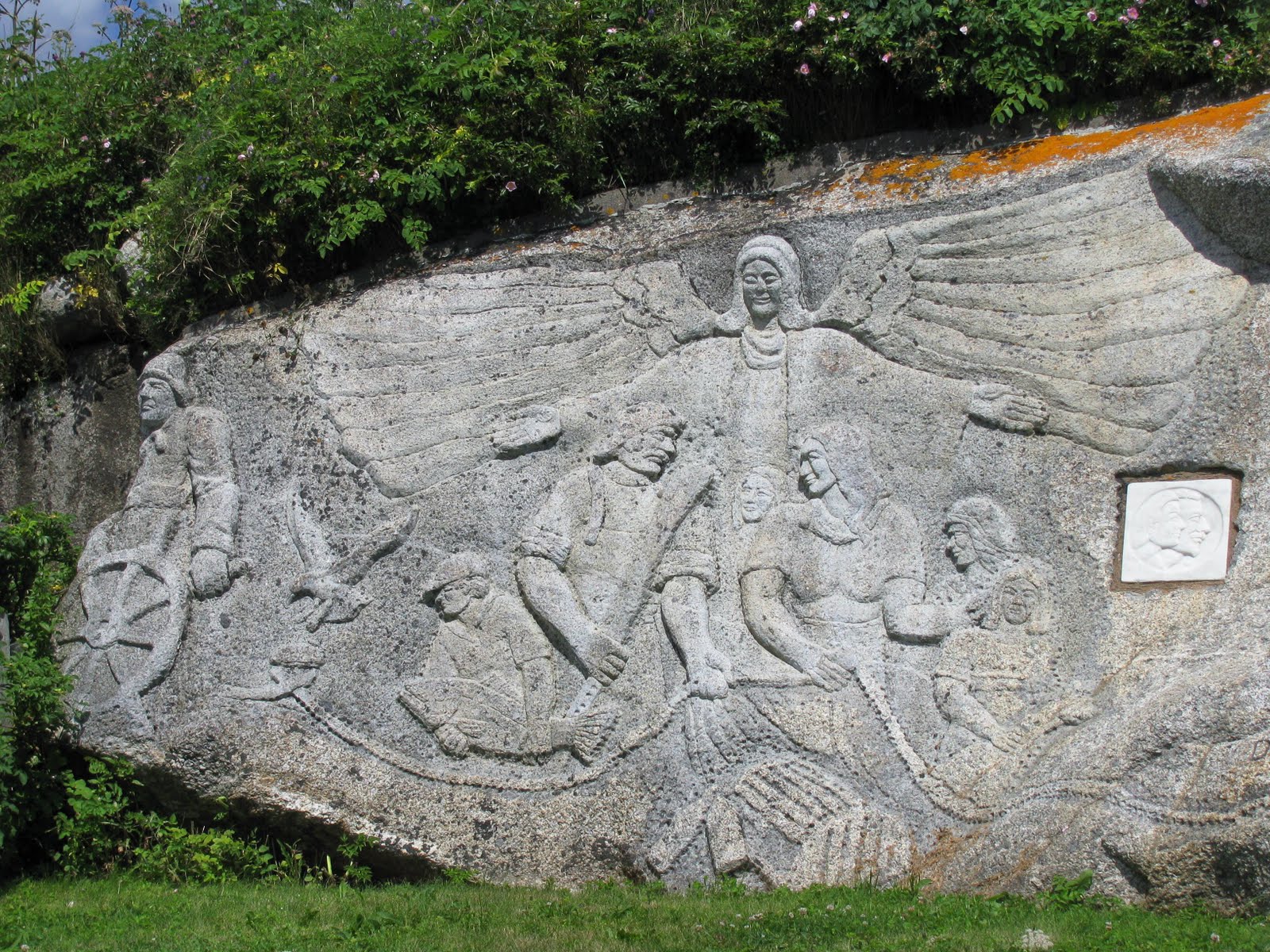 The second section (to the left) is entitled "Bounty" showing people with fish. The third section he calls "Grace". He has an angel, some people and his pet seagull Joe in that panel.
From here we ventured out to the South Shore. French Village resembled a picture postcard. Large homes sit on the hill about the harbor, while colorful sailboats are tethered to their moorings in the water.

Further on we discovered two white sand beaches loaded with sunbathers and swimmers. At Queensland beach we stopped at the "Chip Wagon" for lunch. The menu offered burgers, hot dogs, fish, clams, and of course "chips" /fries. A steady stream of customer came back and forth from the beach. The man who took our order wore the bandanna on his head, in a rakish way. His slender stature, fluid movement and infectious grin brought to mind a pirate. He was very friendly and delivered good food. A second wagon offered dairy treats for dessert or a cool down.

We stopped in Mahone Bay to see the quaint and colorful shops. The Victorian architecture and bright colors welcome tourist to town. We went to see the pewter factory that was a parent shop to the one on the Halifax wharf. However, the pewter worker did not convey all the information we learned at the wharf store. The next town on the route, Bridgetown will be remembered for having a row of spectacular Victorian homes lines both sides of Main Street all the way through town.


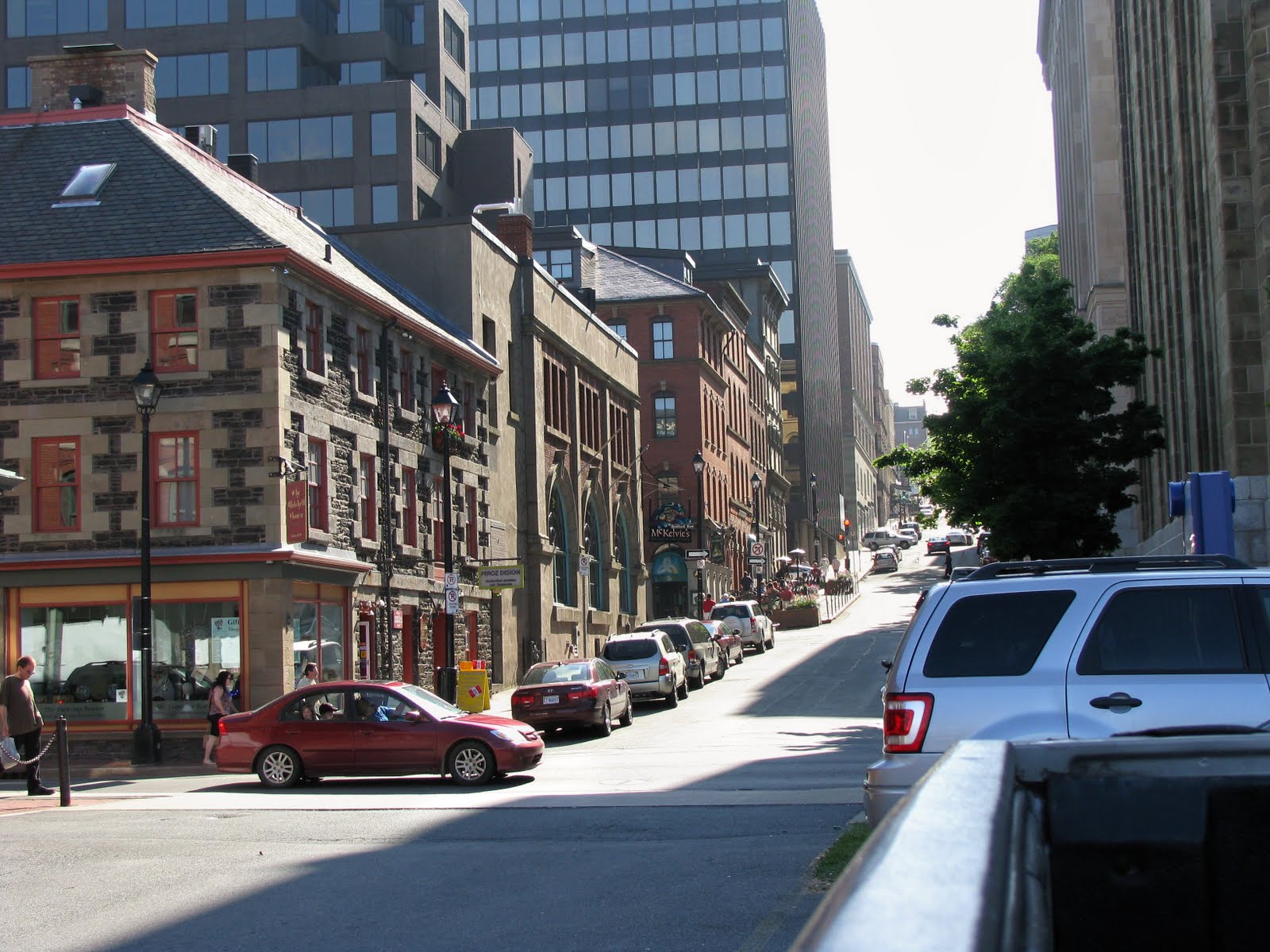
Lunenburg sits on a hill. The steep streets going down from the top of the hill to the harbor remind us of Seattle. The narrow streets descend steeply down the hillside. The cross streets support a row of parked cars on each side, and enough room for one lane of traffic down the center.
 The two storied Victorian buildings sit touching or nearly touching each other. A colorful palette of colors makes an eye-popping array to view. Chartreuse, orchid, blue, red, orange, and green buildings fill the town.
  The backsides of the buildings on "A:" street hangs half way down the hill toward "B" street. Old Town Lunenburg has been declared a UNESCO Heritage Site. It can be described as an example of British colonial settlement planning. With a bay to the front and one to the back, the town is based on a rectangular gird with narrow streets and garden plots. Those gardens were often surrounded by high fences that signal the presence of a deer population.

The waterfront district includes this fisheries house, several big restaurants built against the hillside and a museum. An old sailing ship moored at the dock with the colorful flags can be toured with the museum admission fee.

 The restaurants were fun to just observe.

Along the drive, islands still occur in the waterways...some just a slender bump above the water with some vegetation, and others big enough to support a home.
The day was Monday, and wash hung out on many lines to be dried by the sun and the wind.
Liverpool claims to be the home to privateers. Privateer crews were employed by England to pirate other country's boats on the high seas. We never made it to the downtown or harbor. The long day's travel and bumpy roads said it was time to go back.
Next: Annapolis Royale, Nova Scotia
No comments:
Post a Comment