#36 Baie Verte
Friday July 26, 2019
We left St. Anthony
and made an overnight stop at Port aux Chois.
Loved watching the beach! Then we headed for Deer Lake our next stop.
On our way to Deer
Lake, just beyond Gros Morne this bear tried to cross the road. I felt
fortunate to get a photo since we were moving down the highway at a good speed. The second photo includes the window frame of the motorhome.
Corner Brook has
about 3,100 people, so we took advantage of a visit to Wal-Mart. I also got a haircut and went to a chiropractor.
My fall did shake me up a bit. Besides the people, this town has high rise
buildings, big box stores and the usual town businesses.
I forgot to mention that our half bath toilet
quit in St. Anthony. Anytime water was used in the rig, the toilet filled with
water. We had an interesting 4 days
without easy access to water. We had
acquired an RV appointment in Corner Brook 30 minutes south of Deer Lake. So we drove directly there. The toilet was replaced. Jay and Lynn came down later to order a new door
handle from the Ford dealer.
Deer Lake, the lake,
goes on for miles. Every corner has as
a photo op.
Just before Corner
Brook is the town of Steady Brook with this large ski resort next to the
highway. And….oh by the way….a Tim
Horton’s.
The road between Deer
Lake and Corner Brook makes a pleasant drive.
Saturday July 27, 2019
We took an uneventful
drive out the Corner Brook peninsula. We tried a few short hikes, but the trails
weren’t good.
We did see lots of young people in various
swimming holes, and a lovely little harbor at the end of the road. We see these
orange row boats all over. Not sure if
they are owned or rented.
We found this huge
rock dome island interesting. It is one
of a group of islands.
The big house we see,
continue to amaze! I will be popping
some of these in as we go.
Monday July 29
We have completed our exploration of the Western sections of Newfoundland, Labrador and what is called the Viking Trail. We will explore the Central section next.
A short travel day from Deer Lake put us at the Flatwater Pond RV 12 miles south of Baie Verte. The little town of 1,313 people serves at the center of this mining community. The town has a Subway, a Robin’s donuts (No Timmy Horton’s) and a bistro. A large school sat on the hill and we learned it also has a university satellite here. Pond = Lake
Lynn and Jay arrived
a bit later with their new door handle and we headed out.
To explore this area we went down bumpy, pot-holed, gravel or rocky roads to little coves and communities where no tour bus dares to go! The first adventure took us to Fleur de Lys, population 244.
To explore this area we went down bumpy, pot-holed, gravel or rocky roads to little coves and communities where no tour bus dares to go! The first adventure took us to Fleur de Lys, population 244.
On our way to Fleur de Lys, we passed this old mining area. We assumed it was copper, but later were told this was an asbestos mine.
Many of the little towns have distinctive street sides. This one is Fleur de Lys.
Loved this building with the bright yellow
roof! It certainly stands out among the others.
It may have been a café. This blue house jumped out at us too.
This is Shelly’s
island. She put out a welcome sign.
Wonder who Shelly really is????
Small boats moored on a dock in the harbor.
The Dorset Soapstone Quarry National Historic Site is found in Fleur de Lys. This is the only known soapstone outcropping in the northern hemisphere that preserves evidence of Palaeo-Eskimo vessel carving dating back 1600 years. The Dorset people removed blocks of soapstone to turn into vessels for cooking food and providing heat and light. Hundreds of removal scars remain at this site, evidence of the quarrying process.
The museum displays told the story with pictures and artifacts. The soapstone was taken from the hills with thoughts of its use, like a pot or bowl. The story begins with the Maritime Archaic Indians, the first people to inhabit the Baie Verte peninsula. Then came the Dorset people.
The extraction
process. Don't know if you can read this. Hope so.
The tools
We walked up behind the museum to see the soapstone in the rock and see the quarry.
The guys, of course, climbed to the top of the hill. You might be able to see them on each side of the singular tree.
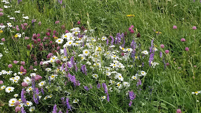
The flowers in the meadow next to the quarry needed a photo.
The colors in this rock caught my eye. And apparently a bit of finger too.
Coachman Cove,
population 105, had the usually neat and tidy homes. They also have a French
Bread Oven. There oven usually had a
grass cover on it. However it was broken
and is getting repaired. Jay, Lynn and Derrille had a nice visit with the
locals. Everywhere we go the
Newfoundland people are eager to talk with you and have a wonderful sense of
humor.
Day 2:
Tuesday July 30
The lady at the RV
park said we “must see” Round Harbor and Tilt Cove. Neither place showed up in the tour books, so
off we went.
The sign for Round Harbor and Snook’s Arm led the way. We arrived in Snook’s Arm population 10 but didn’t find Round Harbor. This area mines copper and gold. The end of the road is a No Trespassing sign. However big mining trucks just barrel down this gravel road.
Next we drove to Harbor Round population 188, not to be confused with Round Harbor, and the storekeeper gave us more directions.
Appreciated seeing the moose even though he wasn't real.
An unmarked road just
before Snook’s Arm jolts you along. One
section was just rocks. Surprise! We meet somebody driving out, who assures us
we on the correct road. He had a cabin down there. Just remember to park at the top of the
hill. (Everyone else told us that too.) Look carefully at the bottom of the photo and you will see the road heads straight down from here. So we parked on the hill and walk to the town.
A couple of men were driving out. One had been born here and came to see it. We were told this town had houses built into the cliffs, and a boardwalk connected them to each other. Well, we were thinking Mesa Verde, and this was just a few houses sitting above the bay with a questionable boardwalk. Some looked lived in. The black flies and mosquitoes dampen my desire to try the boardwalk so we hiked back up the hill. Hmmm
The rocks make you
feel like you are out in the middle of nowhere.
Perhaps we are!
Tilt Cove the next
“must see” turned out to be interesting.
This friendly lady
opened The Way We Were Museum which was in her basement. I am sorry I didn’t get her name.
This lady was born here in Tilt Cove and lived on the north side of the pond in the white house.
Then she married her husband and moved to the south side of the pond. (Their house is next to the man cave.) Her brother married her husband’s sister and they live next door. Tilt cove now has a population of 4. A couple of other houses looked like they may be occupied part time. The RV’s we saw turned out to be old and abandoned, we think. As advertised, Tilt Cove is the smallest town in Newfoundland.
Like the Man Cave?
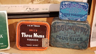
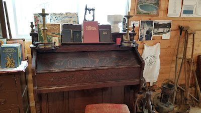
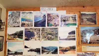
Her little museum
held some interesting stuff.
The history of the
community was laid out in timeline fashion.
It shows 1864 to 1967.
Tilt Cove had 2000
people here years ago. It mined copper and the gold was just profit. In 1912 the mine shut down, some left. In 1957 it started up again.
The scarring of the
land left by the mines showed on the nearby cliffs. The water ran foul. We believe we saw signs indicating hazardous
waste. It is difficult for us to imagine living out here all these years.
The road ended at the
town of La Scie (la see) population 875.
La Scie is the beginning of the French Shore.
Between 1504-1904, the French fishermen were allowed to fish only in the
area known as the French Shore and. It extends over to the West coast and the
Viking Trail villages. La Scie ranks as the biggest fishing community in Baie
Verte. They used to have a fish
processing plant, employing 800 people, but it shut down a few years ago.
We visited the Outport museum. This house also has a tea room.
A lovely young lady, named Liberty, guided us
through the exhibit. Lynn and I really
enjoyed talking with her. She told us
her father used to work at the plant.
Now he and many others “commute” to the Alberta oil fields. Her day has a 10 days on/10 days off
schedule.
One of those large homes. This one in La Scie. How would you like to clean these windows?
An American Airstream
RV caravan was coming to town and the whole town was prepared for their
visit. Three days of festivities were
planned. The Newfies are sooo welcoming. We aren’t sure how the RVers felt
driving miles and miles to get to La Scie.
We finished the day out with one more road. This one went to Pacquet. Another red step trail went up the side of the hill. The guys passed on walking this one.
Getting ready for
winter.
I think we may have blinked going through Woodstalk.
Another interesting day
and we learned a great deal.
Tomorrow Kings Point.











No comments:
Post a Comment