#69 Augusta, GA

Hello Georgia!


Heavy rain kept us home the first day. Check out this Wells Fargo bank building.


Day two we set off for downtown Augusta and the River Walk. The backside of the END says BEGIN.


We found this traffic circle with the clock next to the Marriott’s entrance.

The Augusta River Walk sits on top of the levee protecting downtown when the Savannah River rises.


The bricks under this entrance mark floods: the year they occurred, how high in feet, and how many cubic feet per second.


This particular part of the walk includes the Heroes Overlook. Bronze plaques inset into the brick honor veterans from various wars. Some date back to 1877. Memorial bricks sit between the bronze ones.


A walkway takes you down closer to the water. Here a memorial to the first Augusta police officer, Robert Forsyth, killed in the line of duty Jan. 1794 faces the river. A newer memorial to all of the Augusta Firemen sits next to it.


Across the river, according to the map, sits South
Augusta. However, the Savannah River
forms the natural boundary between South Carolina and Georgia. Thus, South Augusta must have a South
Carolina address.


The park covers about 6-7 blocks of the waterfront. Picnic areas sit overlooking the river at several intervals along the water front.


A lovely playground can be accessed at the east end of the park. A few adult swings invite you to sit awhile.


St. Paul’s Church looks very stately here at the river’s edge.


We climbed to the bricked River Walk. The brick work along the path interested Derrille. Derrille worked in a brickyard for three year using his Ceramic Engineering degree.

He remembers the rounded Bullnose brick being difficult
to make. The Bullnose brick lines the
edges. Most walkways use paver stones (pavers): 1 inch thick to create a path.
Pavers can be brick, stone or concrete. Here, they used a solid brick bigger than
full size. Noting the amount of brick
work, the cost of this walk must be high.

This lovely fountain formed the center of this
roundabout.


Reader Boards dot the edge of the walkway. They tell the story of Augusta. “Navigation” tells that the Savannah River provides a major artery for the Southeast. Petersburg boats were designed as narrow flat boats that maneuver easily through the waters. A veteran boatman said, “Savannah is a lively highway through dangerous and twisted banks. It’s the prettiest river in the world and the meanest to navigate.” A paddle wheel sits out for display.

“Industrial Heritage” speaks
to the dependence on the North, so Augusta became a valuable supplier of food,
clothing, textiles, field machinery, and most importantly gun powder in 1862.


One board tells about the “Founder of Augusta”. James Edward Oglethorpe recognized the potential of this location in 1733. Before Oglethorpe the area was called the community of Springfield.


This plaque shows all the different flags that have flown over Georgia.

After serious flooding of the
river in 1852 cause talk about a “Levee” that finally was started in 1913. A railroad trestle was built and then covered
with soil. The levee held for five
floods between 1918-1928, but a 1929 flood caused severe damage. The levee was
rebuilt in 1930. Today dams and
reservoirs after WWII help to control the water.

Eli Whitney came to Georgia to
teach in 1793. While staying on a plantation he invented the cotton gin, a
machine that separates cotton seeds from the fiber. Cotton became the crop of
the region and the nation’s main export. ”Cotton” commerce made Augusta the
second largest cotton center in the world until the mid 20th
century.


Other boards spoke to the Indians, Topography & Geology, Fish and Wildlife, a Winter Resort, Golf, River Sports, the Great Fire of 1916, and Floods.


Music wafted up from the lower path. A man sat or stood playing his horn as people passed by.


The Floating Stone weighs about half a ton (1070 pounds) and consist of solid granite. It floats on a film of water 15 thousandths of the inch thick. That’s about 5 sheets of paper high. It operates as a lubricated bearing and can be moved by hand as Jay demonstrated.


Part of the walkway included an Analemmatic Sundial for Eastern Daylight Time. This type of sundial lies horizontal (on the ground) with a moveable shadow casting object (vertical). The numbers are arranged in an ellipse. A date line indicates where the object is placed. In this case a person is the object casting the shadow. Except today! The sun was hiding behind the overcast skies!


As we meandered down the walk we suddenly came upon a very large amphitheater.


The “Railroad” board sat at the end of the walk. While we contemplated if the tracks were in use here comes a big, black, locomotive across the bridge and onto the street.


Later when we were under the bridge a second came from the opposite direction. Obviously, the tracks use is affirmative.

From here we walked down to
the lower path and under the railroad bridge and found ourselves at the “Market
at the Marina”. People come to sell
their wares every Sunday. We enjoyed
talking with the lady and her friend selling pralines.

One lady makes her crafts from
recycle plastic. She had some
interesting things.


Another group provided Christmas ornaments for visitors to decorate. The ornaments will be given to veterans.


I had fun with putting my Santa together.


A little store was there with
drinks, snacks and souvenirs. I chuckled
at the display of Vienna Sausages.


Meet Nosy Rosy! Her owner runs the store. Rosy runs in and out like she owned the market area. Maybe she does.


Jay found the ice cream truck café next to the store. He was disappointed that it tasted like ice milk rather than ice cream. Derrille and Jay sat in the tall chairs while I made an ornament.
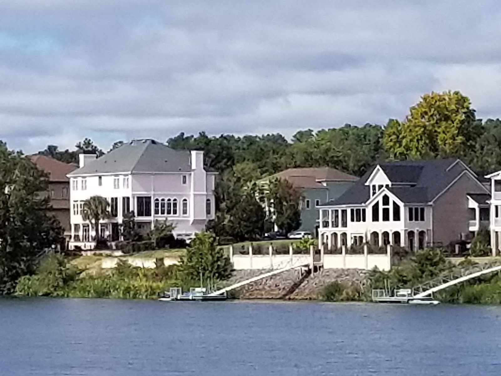


We walked back toward the car via the lower walkway and admired the houses across the river.


One in particular caught our attention. At first, we thought the new construction sat behind the houses on the river. Then we noticed that the new construction’s roof line was scabbed into the roof of the new house on the water. Who needs a huge house still being built and a huge addition? AND what does the neighbor think? We didn’t think the addition connected to both houses.

Next we went in search of
downtown Augusta. We never did find it.
We did find this historical part of the city.


Some homes looked old, battered and neglected.


Others homes looked cares for and restored.

We enjoyed our time on the
Riverwalk. Now we needed place to eat
dinner. I Googled restaurants and selected the Crab Pot. We found it and…..it is brand new and not
open. We drove to choice #2 Mr. T’s
Seafood……it has been vacant for years.
We decided on Big Daddy’s Grill Bar and Grill!


The food was award winning and delicious! We had a great dinner and great laugh.
Off to Atlanta
No comments:
Post a Comment