Sunday, July 28, 2019

#32 Port au Chois to St. Barbe


#32 Port au Chois to St. Barbe

July 18, 2019


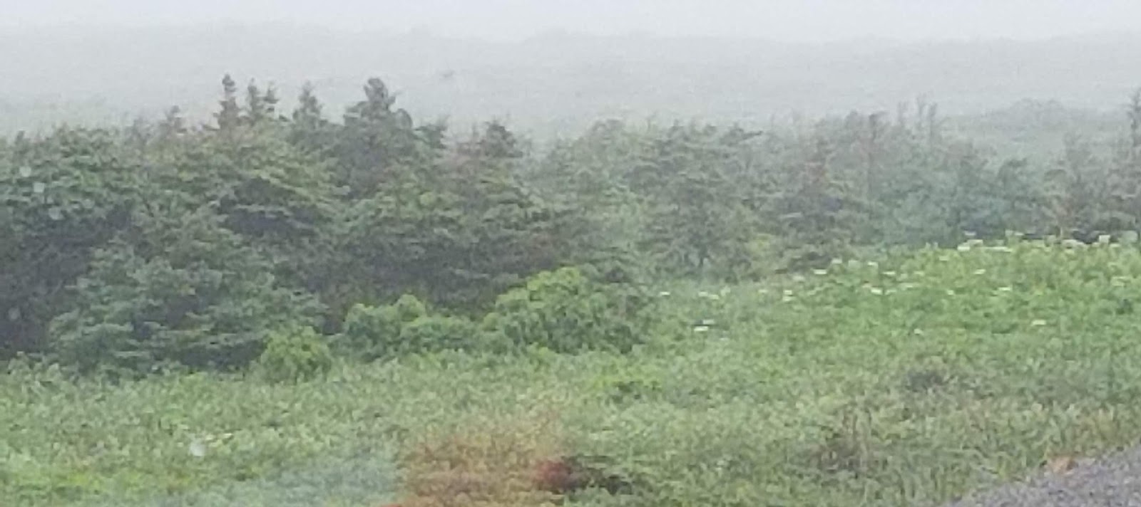
The road led to dark green forests and interesting color in the flat mountains. The dark areas in the mountains are rock strata.  I wondered if that was a building in the crevice, but a closer look indicated it was two snow fields around rock.


The sun shone brightly as we followed the Gulf of St. Lawrence.  The water lapped the shore in shades of blue and green.  White salty waves splashed against the rocky shore line.


 All along the way piles and piles of logs lie near the highway.


 Some areas looked like a lumber yard. We made many assumptions as to who cut it, who used it, who paid for it, etc.  What we learned from our museum guide is that all of the piles are privately owned.  No one can store enough wood at their houses, so they get a permit to pile them where they can. Apparently everyone knows who owns what.  No one touches another man’s wood pile.


We passed one of the many little communities along the road. I happened to capture a fisherman fishing in the river.


Viking Trail Academy educates the children in this area.  It is a K-12 facility.  I spoke with three girls from there when we toured the 50 Century Museum in Bird Cove. This looks very typical to other academies we have seen.


Puddles and ponds continue to fill in the low areas of land. The one next to the wall of rock looked heavy with iron.


Liked this shot of the gulf. 


The turn off to St. Barbe came at this corner.   As we came into town we spotted our first iceberg.  Only 180 people call St. Barbe home.  This RV park is a parking lot surrounded with chain link fence.  It is literally a “parking lot” as most tourists leave the rigs here and just take a car over to Labrador.  Met some interesting people here and on the ferry and in Labrador. You bump into each other at the different sights and restaurants.  We also got our first glimpse of an iceberg here.


After setting up, Derrille and I headed for Bird Cove.  This sign made me laugh.  I wonder why they chose this short stretch of highway to add this warning. About 98% of the roads show weather wear with lots of potholes.
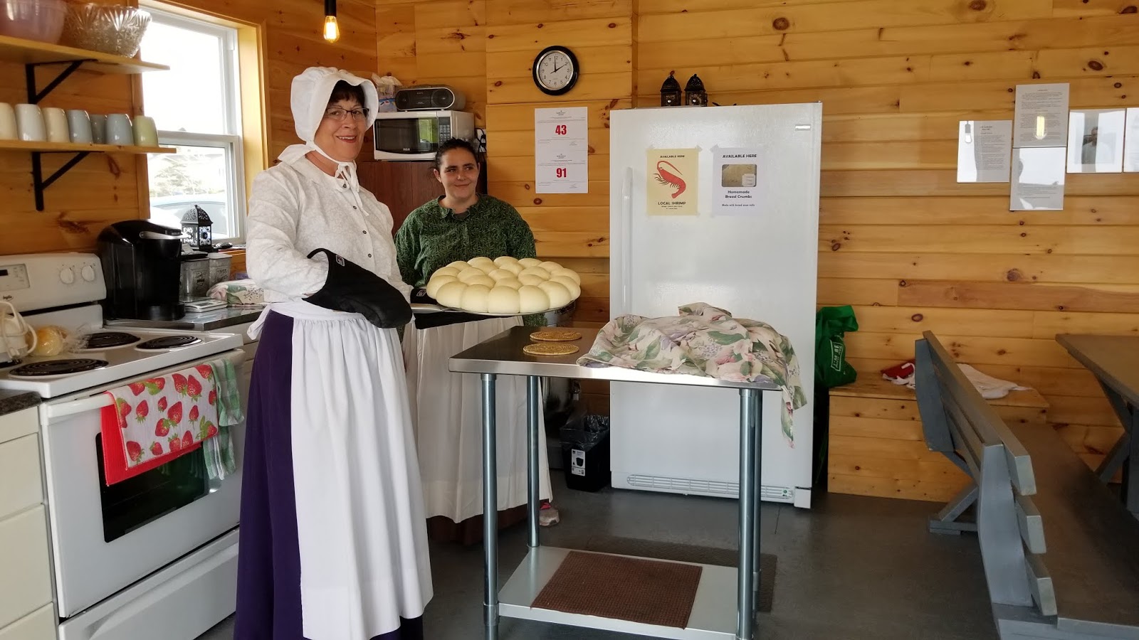


The 50 Centuries Interpretation Centre of Bird Cove was just a bit south of St. Barbe.  A very knowledgeable young lady gave us a guided tour.  She is a college student in Thunder Bay with ambitions to become an anthropologist and forensic scientist.  One other helper there is going to college in Corner Bay and majoring in business.  I think the third young lady just graduated in June from grade 12 and I don’t know her plans.


In the rock collection of fossils and old rock this one interested me.  Our guide said it may have been a grave marker.  I’ve never seen anything quite like it.


This fossil sat at the bottom of the sea.  Therefore the foot impression must have come from a sea creature.  The dark rock with the notches is thought to be a calendar of sorts.


The limestone pavement felt so smooth, like glass.  On our return from St. Anthony back down the this highway, I spotted several areas with the limestone pavement on the beach.


I liked this Einstein quote.


This full Minke whale skeleton washed ashore and men brought it in pieces to the museum where it was assembled.  It is one of the few full skeletons.  The Minke is one of the smallest baleen whales being only 25 feet long. However it also claims to be the most abundant. Like all baleen whales it has two blowholes.


When Captain Cook came to the area, he charted the land. This represents his original shoreline map, which is quite accurate.   This rock cairn that Captain Cook built in 1754 on the shore here still stands.  Local people know not to touch it, and visitors are told to do the same.  One of the amazing things about this area is no one bothers or destroys pieces of history or other people’s things. They  just don’t. How nice is that!


Check out this garden we passed by. It was next to their home.

125030  121823


We have seen gardens along the highway in areas without visible housing.  We have learned these plots operate like the wood piles.  When the highway was built the good top soil was moved to the sides of the road. Since good soil is hard to fine here, people get permits and put in gardens next to the road.


LOL  Just another house with a front door and storm door and side panel, but no way to reach it. Remember regulations require 2 entries, but no porch is required for both, so it saves money and material to do without.

 Labrador Tomorrow!


#31 Port au Chois


#31  Port au Chois

July 16, 2019


The rain from yesterday continued to spill from the sky during our drive.  Fog drifted around us in some places. Then it lifted.


We noticed the sides of the road had been cut back.  Not as far as they do in Alaska, but far enough to warn of critters approaching the road.


We believe they want you to slow down here. 50 km = 30 mph!  BIG speed limit signs! The perspective here is skewed, but look at the yellow curve sign in relation to the speed limit sign.


A series of little towns and bays lead to Port au Choix.    Usually spelled Port au Chois and pronounced [Port o Schwa]


The Oceanside RV park run by the local Lions Club sits right on the beach looking at the Gulf of St. Lawrence.   A large caravan was expected for tonight, so we had to park facing the highway. 


But then….the caravan cancelled and we secured a spot on the beach. 


 Large flat rocks lie just off the beach. We can watch them all day.The top photo with the reddish picnic table was our view directly out our front window.
By the time we set up the sun shone high in the sky.  Taking advantage of the good weather we headed out in search of another French Bread Oven.   We found it at 1:54 and the demonstration started at 2:00.


This part of the peninsula belongs to the French Shore.  A treaty with England allowed French Fishermen to fish here.  They brought their bricks with them from France and set up ovens all over this shoreline.


Then they left the ovens and used the salted cod as ballast for the trip back to France.


 The ladies, dressed in period costumes lit the fire at 11:00 in the morning.  By two the oven temperature reached 400 degrees.  They made the rolls and let them rise twice.  The second time needed two hours.  The perfect looking mounds nestled together on a large baking sheet. 


Once the oven has reached temperature, (as determined by a modern oven thermometer) the coals are removed.  The rolls are ready for baking.  To our surprise, this batch of rolls only needs about 5 minutes in the oven to bake.


Fresh out of the oven and on to plates!  The tables inside included settings of butter, molasses, blueberry jam and partridgeberry jam.  Both jams had whole berries in them.  YUM!  You may remember that partridgeberries are lingonberries.  They have a tart flavor.


 It surprised us to find the rolls here were definitely different than the ones on Cape St. George.  We wonder what we will find at the next Viking Village stop.


This Chaloupe represents the typical boat the fishermen used.  They were brought over on a larger ship and used to fish here.  Three sailors manned the boat: the catcher, the baiter and the rower.  Once they had their catch all three rowed back in.  Period clothing is available if you would like to dress up and have your photo taken in the boat.  Not our thing….
But you have to admire the courage of these men that took this little boat out into the open sea in all kinds of weather.


At the French Rooms cultural center, a young man named Allen gave us a personalize tour of this little place.  His knowledge gave us many new insights about Port au Chois.


Port au Chois provides a home for about 900 people.  Children need to go to the next town to attend school.   Allen said regardless of the plain looking outside the large, Shrimp fishery has state-of-the-art equipment and employs most of the town.


  The creation of Port au Chois is credited to three French sailors who deserted their ships. They are in the first three photos. Joseph Breton & Wilbert Farewell are in the first photo. Don't remember who was the desertee. Then Frank Hillary, followed by Joseph Gaslard and his daughter. They said the captain’s cruelty made them do it.  Locals hid them and they learned English to avoid capture.  Today there are no French speaking people in this area


One of his interesting stories told of a time when little pockets of people lived all over the land. The governor decided to relocate people to take advantage of services.  The plan looked great on paper, but not so much in reality.  Port au Chois was designated as a growth area and people were to come here.   Unfortunately housing couldn’t be secured and all kinds of problems occurred. To solve some of the housing problems, people relocating brought their house with them if close enough to the new place.  They floated the two-story houses across the bay.  That was the easy part.  Getting it up the beach and then the hill to its location may take two days.  They floated about 200 homes and never broke a window.  They did damage the siding considerably and sometimes flooded the first floor.


The Point Richie lighthouse looks like many we have seen before except visitors were not allowed.  We appreciated seeing it lit at night.


However grazing on the shore stood 3 shaggy and mangy looking Caribou.  We hope they are molting, because their coats were a mess.  But they are our first signs of real wildlife we have seen, other than the quickly disappearing moose by Cape St. George.  We think the third one had a calf with her.


This interesting structure is part of the Dorset Palaeoeskimo summer site. Several depressions in this area have been researched as dwelling sites.


The next day we took a short excursion to the town of Hawkes Bay.  The Torrent River Fishway helps the Atlantic salmon get by the falls and spawn upstream.


Inside large flags hang from the walls.

The inside exhibits traced the history of the Torrent River. The Torrent River runs through this community.  The area went through a 20 year logging boom.  Logs were cut in the fall, and hauled by horse onto nearby ponds where they sat until May or June. Then the logs were “driven” down the river.  The logs scoured the river bed and disturbed gravel necessary for spawning.  In the late 1950’s the spawning habitat was bulldozed to improve the flow of wood.


A wondrous set of falls 10 meters (35 feet) rush over the rocks and formed a natural barrier simply too high for the fish to jump.   Then the highway came and brought more anglers to fish.


The end of the inside display talked about Fly Fishing and the Catch and Release program. It had this set of tied-flys there.  My thought is these aren't anywhere near as nice as the ones my brother-in-law Roger creates.


The guys!

Between the logging, falls and more fishermen, the salmon numbers were dropping.  In 1962 an alert went out.  In 1965 a plan was in place to create a fish ladder through a series of elevated pools. But the plan didn’t work.  The materials used to create the ladder begin to crumble and crack. Also poachers presented a problem.  The problems were solved and an elegant fish ladder allows the salmon to reach their spawning grounds.  Today more than 5,000 salmon pass through the fishway, which is double the expected number in 1962.


The concrete fish ladder is under the grates. Grates help prevent poaching.


As the fish pass by they can be viewed from the downstairs of the center.


 A door prevents them from continuing up the ladder.  The workers turn on a camera, and then open the door for a period of time.  They open the gate several times a day and go through the process.  Then they count the number of fish passing by. 

The Dept of Fisheries also reviews the tapes and recount.  They also look to see how badly the scales are marred.  Apparently before they get here they pass through an area that can gouge them. The condition of the scales determines their health.


Nice visual of the salmon reproduction cycle.


After touring the building, we went to a lookout below the falls.  There we saw salmon trying to jump the falls.  Hopefully he or she will figure out how to find the fishway.

As a side note little black bugs that are thick on the west side of Newfoundland this year decided they liked me and swarmed around me at the fishway.  I was covered! We, all, had to brush off our clothes before getting into the car.  Yuck!


Tomorrow St. Barbe and off to Labrador