#6
The Battlefords
Derrille went to turn on the fireplace this
Monday morning to discover it wasn’t working either. Checking the simplest solution first he went
to the electrical box. We were not pulled in!
LOL
We
were too tired to remember last night.
Our smart RV put us on inverter power for the night. Surprise! Once we plugged in everything worked as expected.

Derrille did walk his 4-5 miles and do his exercises out by the RV even with the huge mosquitos. Fortunately most insects don’t bother him.


Mosquitoes and other critters clung to the sides of the RV. I didn’t go out unless I had to do so.

Derrille did walk his 4-5 miles and do his exercises out by the RV even with the huge mosquitos. Fortunately most insects don’t bother him.


Mosquitoes and other critters clung to the sides of the RV. I didn’t go out unless I had to do so.

Our first touring destination of today took
us to the town of Battleford and a guided tour of Fort Battleford. Misha, our tour guide, gave a clear and
knowledgeable of the fort’s history.
Although the fort wasn’t anything special, her interpretation made it
very interesting. She used easy to understand language describing the fort’s
history. Her depth of knowledge showed in her presentations and how she
answered all of our questions.

The wind blew across the grounds at what felt like gale force winds, and rain spattered from the sky. Can you see the grass leaning?

The tour began in the museum area of what
was once a barracks. We were greeted with this Gatling gun.


Three types of soldiers manned this post. When some of the Royal Canadian Mounted Police were needed elsewhere, 42 civilians were sworn in to help. Another 54 militia also came, and they wore a mix of military and civilian clothes.

The western movement story seems to repeat wherever we travel. Europeans come to a new area. They commandeer the land, sell it to settlers and totally dismiss the populations of people who already live there, and have for years. They make treaties and don’t keep their promises. The starving first nation people seek what was promised and skirmishes break out. Both cultures misunderstand the others intent and what follows often results in war.
Both Derrille and I were struck by the
similarities of governments and their “enemies”. At Gettysburg, Little Big Horn, several Civil
War fields and St. Augustine to name a few places, one officer either doesn’t get the message from the commander or
ignores it and acts on his own creating a more difficult situation than there
was in the beginning.

The construction of the fort fence
originally used tiny logs with spaces between them. The fence here was made
later. It wasn’t for protection as much as keeping wandering animals out.

The first building replicated the
jail. Several of these buildings
occupied space within the fort area. Like the jail buildings, several vet buildings were on base to help sick horses.


Each jail area had 3 beds for the guards. Off
duty guards slept in full uniform, with the exception of their hat. Then they
were ready if they were needed. Misha is
much cuter than I captured in this photo.


Three cells on one side secured with wooden
latches for minor offenses like being drunk, or a lady showing her ankles, or using bad language or spitting. The
three cells on the opposite side shut with iron latches to contain the major
offenses like murder or theft. The wash area was used by guards and inmates.

The photo will show you the tiny size of
each cell. Sometime the cell bed was removed and 6 or more people shared one
cell.


The second structure, the veterinary
stables was one of many stables within the fort, just like the jail.


The importance of the horse cannot be
understated. Horses were highly valued
and cared for better and before people.
The stalls for sick and contagious horses set across the barn from the
horses needing care for a major injury.


The vet’s office

The horse’s hooves were numbered and when they died the hoof was cut off as proof of death. Then the army was assured that the horse was not sold.

This log between stalls swings to avoid a
soldier from being crushed by an upset horse.

Beside the stalls, a fire wagon was available if needed.


We moved on to officer housing. Misha
reiterated the importance of rank and how officers would show off the perks of
that rank. Touring the houses really
highlighted the differences. The lower
officer’s house looked very nicely appointed.


However in this house perfect for a family
of four, two officers and their families shared the quarters. One of the families here had 11
children. As the first nation rebellions
grew, the settlers became scared and moved into the fort. Women and children,
about 75 occupied this house.


Officers and Royal Canadian Mounted Police slept outside in tents. The smaller tent is for the officer who gets to sleep alone. A trip to the river to get water presented dangers during war times. Thus water was rationed and used just for drinking.


The officer’s offices were part of the
house. The commander sat facing the lower ranking officers.


This device acts like a printing press. A
document is inked and then put into the press on another sheet of paper which
receives the ink. After a day or so, the new copy is taken out, but of course
the print in backwards. So the process is done again to get a readable copy.

These blue bottles sat on these small shelves in several rooms of all the buildings. They are mini fire extinguishers. They are filled with chemicals that will douse a fire.

The settlers were also ordered in the event
of a siege; gather around the ammunition in the middle of the parade ground, so
the soldiers could keep both the ammo and people safe.


The commanding officer’s home took definitely showed the benefits of rank.


We entered via the summer kitchen, a large open area that kept the heat from cooking and canning away from the house.


In
the winter the stove was moved upstairs to the winter kitchen and used to
provide warmth.
The man in the photo was on the tour with us.


All of the furnishing appeared upscale to the house next door.
The man in the photo was on the tour with us.


All of the furnishing appeared upscale to the house next door.
One
commanding officer was single. It would
be improper to have a woman in the house, so one of the enlisted men did his
cooking and cleaning.


The Fred Light Museum just down the
street lives in what originally housed a
3 story Catholic School. Crosses on the
stairway newel posts caught my eye.
Floors one and two include the Education Room, The General Store, The
History Room and the Veterans Room. The
Gun Room on the top floor looked a bit like the Gun rooms in the Cody Museum in
Cody, WY, only on a smaller scale.


I was blown away in The School Room where Dick and Jane books sat on the old wooden desks. Posters from the reading series sat on the chalk tray. I taught reading with those books in 1968!!!!
Oh my! Of course if you do the math 2018-1968 does equal 50 years! The Fred Light rooms brought back memories. Oh, I remember that! We used that. We still use that!

I also remembered this microscope. I may have used it in my classroom too.


Here are some teacher rules to ponder. I
used to give copies of these to my student teachers.


Ye Old General Store was stuffed with
memorabilia. This info with the Wooden
Indian was interesting.


The PBX board in the History Room brought
back memories. I operated one of these on my first job. Was it ever fun!
Outside, blowing in the wind stood a White
Rose Service Station sign. If any of you
like Toby Keith, you might know one of our favorite songs that tell the story
of the rise and fall of the White Rose Gas Station. I thought I had a photo of it, but it didn't take.
Being this far north at 4 pm the sun rides
high in the sky. It’s too late to try
another museum, but we can drive out to see the Crooked Bush. To find this
tourist attraction means going over the bridge and back through North
Battleford. We drive east on TC-16 to
where it intersects with Highway 40. We
drive about 30 miles east on 40.
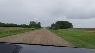


We exit 40 to what else??? A dirt road!

The directions take us north 10 miles on this dirty, dusty road before we spot the sign and turn to a smaller dirt road.
 The Crooked Grove more aptly names this copse
of aspen trees that forgot to grow up and tall.
Their trunks twist and turn for no apparent reason. Folk lore suggests they were influenced by
UFOs.
The Crooked Grove more aptly names this copse
of aspen trees that forgot to grow up and tall.
Their trunks twist and turn for no apparent reason. Folk lore suggests they were influenced by
UFOs.


A little boardwalk guided us through the grove. Kind of a funky experience!


We exit 40 to what else??? A dirt road!

The directions take us north 10 miles on this dirty, dusty road before we spot the sign and turn to a smaller dirt road.


A little boardwalk guided us through the grove. Kind of a funky experience!
Although we did not see a World Biosphere
at Redberry Lake, the reserve claims to be home to 200 bird species including
the rare American White Pelican.


Our silver car looked tan after our trip on
the dirt roads. That is the apparent
color of many Saskatchewan cars.


Whoever came up with these neon signs must
have made a lot of money. They were all
over. We even saw them in other cities.


We finished the day off with a lovely
dinner at a restaurant called…blend. The delicious food topped off our
adventure today. Our young, stylish
waiter, Erik lives here on a farm and willingly allowed us to ask
questions. We learned a lot from his
answers. Note how exits are displayed in Canada.


All along the roads in Saskatchewan, pools,
puddles, ponds and slough like bodies of water appear on both sides of the
road.

We noticed that in some places the vegetation looks dead. In some areas stacks of dead wood are piled near the water.


Some water includes a frothy substance similar to the frothy salt the ocean may bring in. Some pools have an algae growth. Other pools look clear and clean. Did they occur naturally? Do they come up from below?
He explained to us that when the government built the roads the specs say they are to be straight and level. Ahhhh we’ve seen that!
Well to create the roads, they dig dirt
from the sides and even out the roads. Thus a depression in the ground that
fills with rain, snow or ground water. To appease some farmers, the deeper
depressions were stocked with fish. We
did notice water fowl likes them. The
water is exceptionally pure. However,
too much water kills the trees and brush eventually. Some farmers heap it up,
wait for it to die and then burn it.


Erik also explained the use for the black tanks and silver or white silos, which I’ll tell you about somewhere else.


Erik also explained the use for the black tanks and silver or white silos, which I’ll tell you about somewhere else.


Before heading back home we stopped to pick up some groceries. Erik suggested we go to the CO OP. We entered the store and were surprised that the CO OP had a mall inside. I also have never seen an aisle directory include ice cream cones.