Blog #1 Bremerton to Moses Lake:

The rig is
loaded. The plans are made. The
adventure begins! We are headed for
Newfoundland!
The itinerary shows a departure date from
Bremerton on June 4, 2018 and a return to Chula Vista, CA on November 20, 2018.
We enter British Columbia, Canada via Idaho.
Then travel across Canada with some stops along the way until we get to
Nova Scotia. There we travel by a HUGE ferry to Newfoundland. After exploring the island for 2 months, we
will continue down the east coast of the states to Georgia before coming back
across the south to California.
Disclaimer: many of my photos will be taken either with
my phone or camera, out of the window as we head for our destinations. Quality may be affected by speed of travel and
the amount of bugs on the windshield. I
expect photos taken at each destination to be remarkable better.
Launch Day 1:
For those of you who do not know me well, I am preferably…. a do-not-do-mornings person. I enjoying
rising about 9 am and heading off to exercise.
However, I can rise earlier if necessary. We planned a Monday, mid-morning departure
for this adventure. Then I got the call
back for my mammogram. We left about 8 am for my 8:30 appointment thinking it
would be quick. Wrong. The exam showed the need for a biopsy. Bless Harrison Imaging! Knowing we were ready
to embark on a six month trip, the staff quickly arranged for an immediate
biopsy procedure. We were home by 1 pm,
ate, packed up and were on the road before 2 pm. Hiccup #1.....A 5 hour imaging appointment was not part of
today’s itinerary.
Oh well…..Stuff happens!

We made good time getting to I-5 only to hit
pre-rush hour traffic. Hanging out in Phoenix, San Diego and Portland teaches
travelers to avoid freeways between 3 pm and 7 pm if possible. The traffic gave
us time to look around and realize we haven’t traveled this stretch of I-5 in
about 8 years. We slowed down through Auburn and Kent.


As we
began our climb up the Cascade Range toward Snoqualmie Summit the traffic fell
away with the cities. Tall and stately
fir and pine trees covered the hills and lined both sides of the highway. Waterfalls cascaded down the mountain
sides.
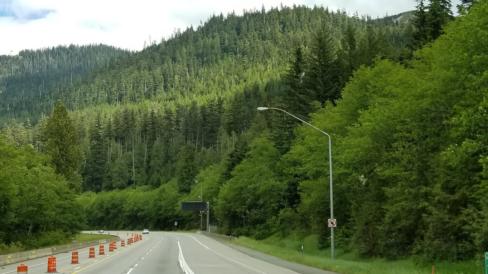

Patches of snow dotted the tops
of the highest peaks. The ski resorts
of Snoqualmie sported grassy slopes this June day.

Keechelus Lake east of the summit appeared
completely full. We have seen it decimated in
the past with stumps rising out of the low water levels. Today gentle waves
lapped the edges under the cloud covered sky.

Road construction was underway right on the
banks of the lake. The massive project shows an additional 2-3 lane highway
under construction. High above the new road, two lanes travel west, and another
two lanes travel east. Eastbound
travelers can look directly down at the new road.


Descending the eastern slopes of the Cascades
two things become obvious, the sun is out and the temperature has risen four
degrees to a warm 64 degrees. Wind farms stretch across the farmland.
The road follows the Yakima River as it meanders toward Ellensburg. Signs alert drivers to free range livestock who may wander onto the road. Some cattle remain in fenced pastures.

The road follows the Yakima River as it meanders toward Ellensburg. Signs alert drivers to free range livestock who may wander onto the road. Some cattle remain in fenced pastures.


Around Ellensburg, now 68 degrees, I noted the
use of hay tents. These plastic tents,
many red and white stripes, look like little barns. In the past hay was
shrink-wrapped into cylinders. We saw
some of those, but the tent structures were more popular in this area.


We saw
fields of freshly mowed hay and some that had been baled but not
collected. The collected hay bales were
then placed in tents of varying sizes.


In some areas the hills appear barren, but the field are irrigated and green.


Herds of cattle munch lazily in the pastures, under the blue cloudless sky and bright sun.

This railroad trestle stood out against that bright blue sky

An abundance of wind farms use their giant rotor arms to change the wind into electricity. I found it difficult to photograph with any perspective on their actual size. You may be able to see vehicles just below a windmill. We have seen a single rotor arm being transported on an extra-long semi-truck. The wind farms fascinate me as the turn consistently on the mountain tops.

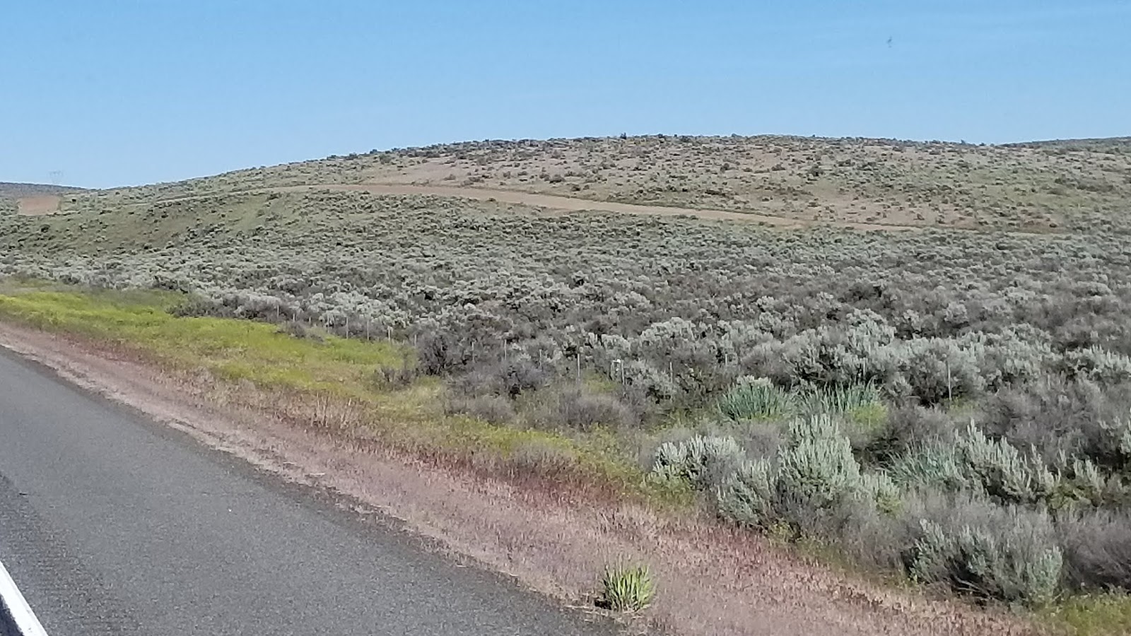
Their windmills stand like sentries on the sagebrush landscape. I find it interesting that this area not only support wind power, but also hydroelectric power produced at Grand Coulee Day and other dams along the river.

The highway descends for 10 miles at a 4%
downgrade toward the little town of Vantage (temperature now 73 degrees) and
the Mighty Columbia River.

To my friends in Arizona, this is what a river looks like! The Columbia River cuts through Washington State north to south. Then it turns west on its way to the Pacific Ocean, forming the boundary between Washington and Oregon.


If the pioneers of the mid 1800s knew then what we know now, the western halves of Washington and Oregon would be the west state, and the eastern halves of Washington and Oregon would have been another state.
Then each state could deal with common issues.

 As the highway crosses the bridge the road rises
quickly in elevation. Stark and stoic
rock outcroppings tower over the highway.
As the highway crosses the bridge the road rises
quickly in elevation. Stark and stoic
rock outcroppings tower over the highway. The Columbia Gorge can be viewed easier from the west bound lanes, but I got only a quick peek or two as we climbed the grade.

The farms of Central Washington show strong signs of spring. The vineyards of Central Washington are well thought of, and many people make an annual trip here in the fall to purchase Washington Wines.


Some farms have irrigation and gigantic sprinklers watering their crops. This part of Washington looks a lot like the farming areas along Highway 101 in Northern California. Sometimes their spray made small rainbows as we passed.

We crossed the Columbia, and traveled to Moses Lake where we spent the night in the Suncrest RV Park just off Hansen Road. Very nice...clean, neat, pool, and other amenities.
No comments:
Post a Comment