

We deflated our air bed in anticipation of going over the Canadian Rockies with maybe high elevations. The border was only a few miles up the road.


The few miles to the border gave us wonderful sights.

A river flowed alongside the highway, crossing sides once in a while. You might note that we are out here all by ourselves. An occasional trucker passed going south, but for the most part we traveled in quiet peace.


Then came the town of Yahk. The signs show the rural nature of this land. It amazes me that people exist in this blip of a village along the road.


The custom signs in
Eastport, informed us that we would pass the U.S. customs first, then the
Canadian customs. However, we did not see any U.S. agents and drove directly to
the Canadian booth. The sweet young lady asked the usual questions, our
destinations, how long in country, did we have firearms or alcohol, etc. She
looked at our passports. She asked if we
had been in Canada before and we said yes.
She said,” Have a nice day!” She
didn’t ask one question about food or ask to come in. It took less than 2
minutes.


We continued along
the mostly deserted road. Trains tracks ran close to the road.

We continued to enjoy
the beauty of foothills before the Canadian Rockies.


Summer road travels
must include road work. I wish I had photographed one of the work zone signs.
The Canadians have much more polite language on some of their signs than found
in the states

Note the phrasing on this passing lane sign. Canadian signs appear polite. Some signs even say please.


Moyie must be
something significant. Lakes, rivers,
and towns carry this name. This little town is another one that looked like a
place to explore. The surrounding mountains look like this.


Every town in Canada supports Tim Horton’s. A line in the drive thru lane remains constant, just like Starbucks Coffee. Timmy also sells, coffee, tea, delicious, out-of-this-world, donuts and sweets, and Derrille says they also have sandwiches. On our last trips through Canada we bought the 4 of us a dozen donuts each visit, because that was the cheapest way to go. We also learned to know exactly what you want before getting in line, or you will asked to step away until you know what you want. In this small town of Moyie, two Tim Horton shops sat within two blocks of each other. Of course one was on the north side of the road, and the other on the east side.


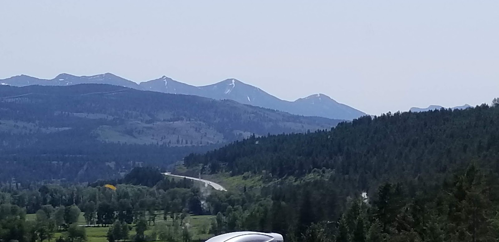


We begin our journey through the Canadian Rockies. The mountain views continue to mesmerize me. They appear close enough to touch.


The country tries to look out for its
wildlife. We found two animal detection areas here too. Flashing yellow lights
indicate that livestock is in the area.
We looked but didn’t see anything.


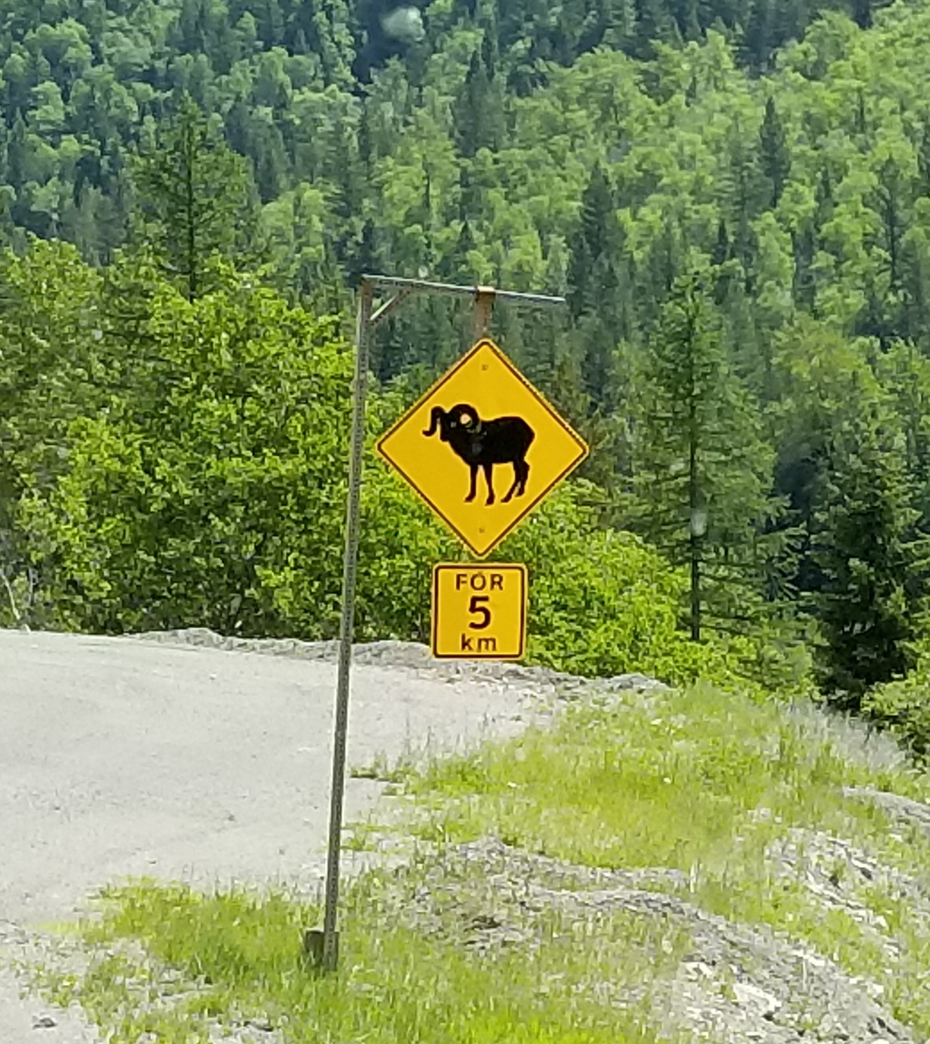
Elk sign, Rocky Mountain Sheep sign, Moose signs and regular deer signs occur along the highways of the Saskatchewan and Manitoba. Not we saw any!


A great deal of construction went into making Canadian Highway 3.


Collections of snow still dwell in the mountain crevices. Some mountain clearly showed their fold-fault lines showing where the earth had pushed them up and tipped them.

We came around a turn
in the road and met this tunnel carved out of the mountain.

The other side opened to more river views and mountains.


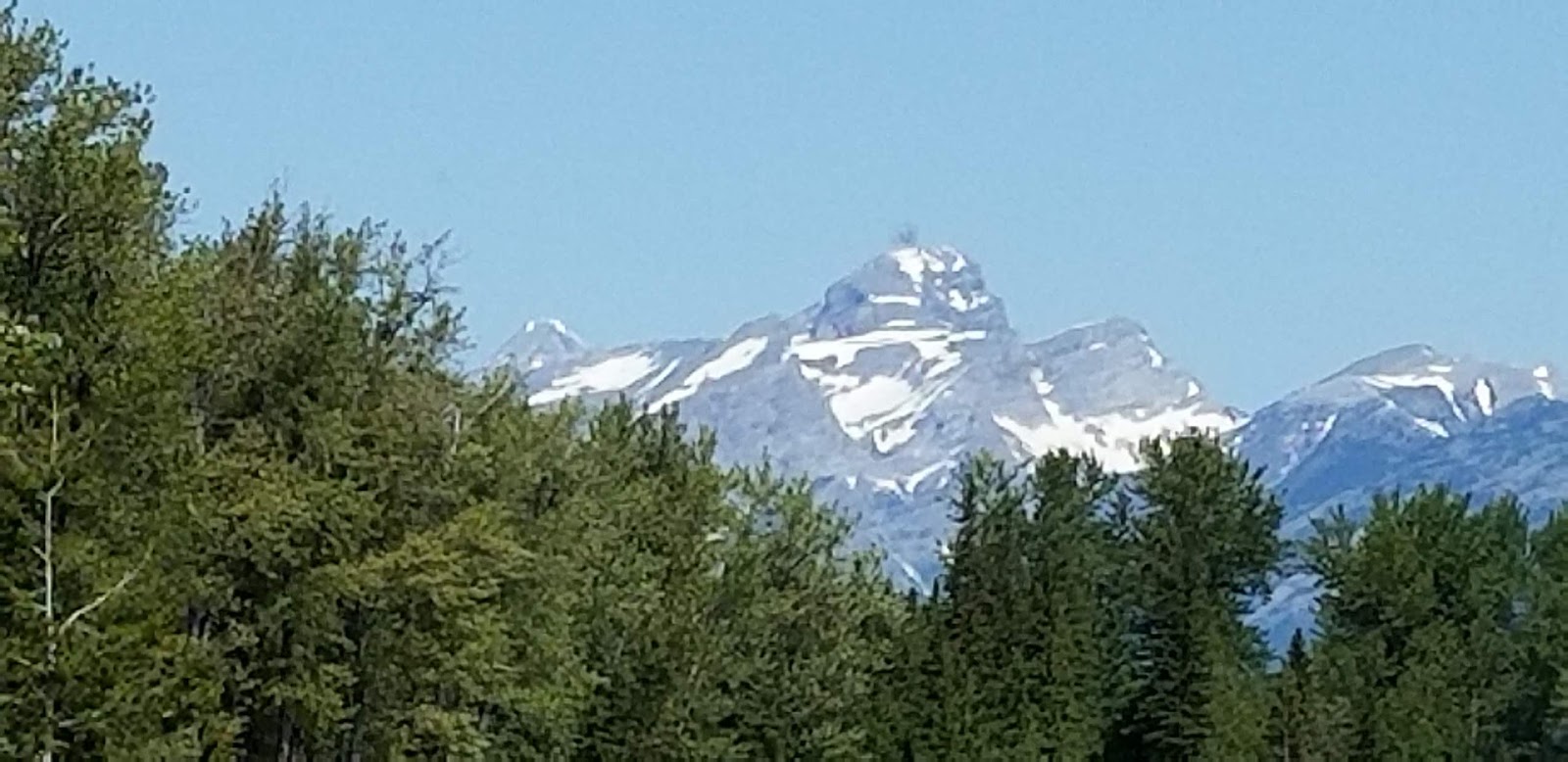
Following this snowy mountain top as we got closer and closer may give you an idea of what it is like driving through the Canadian mountains.


At first I thought the crevices on plateau were made by ice age glaciers. Then I wondered if they might be ski runs. Later I returned to my first thought.


Fernie looks like a
typical ski resort. Several large hotels
can accommodate guests. Shops and
restaurants await the tourists. The usual array of fast food joints include
A&W, Mc Donald’s, and of course, a lovely Tim Horton’s. Kayaks could be rented for trips on the
surrounding rivers. Hiking and biking
trails were also noted. Fernie appears
to be your year round outdoor adventure site.


As we left town I shot this photo out the left side window, as well as a mountain out the front.


The little town of
Sparwood likes to lay claim to the biggest truck in the world. Perhaps it
is.


Hello Alberta!


Crowsnest Pass comes next according to our map. This rock may be THE Crow’s Nest.


Traveling various
mountain passes, we expected to summit and see an elevation sign and maybe
something like a general store. Crowsnest
Pass follows about 10 miles of the highway not to mention extending both north
and south of the road. Homes sat by the
river in the valley. Neighborhood sat
on the south side. Look carefully and
you can see two rows of RVs. One row
sits high on the hill. Advertisements
invited traveler to learn of the Rum Runners stories of another time. A quick peek down looked like an Old Town
section, with relics from past mining and of course rum running. A sleek new hospital covered acres east of
town. New homes sprung on the ridges. A sign posted along the road told of a
meeting to discuss the creation of a sports complex.
Several of the little
town along highway 3 look like a several week trip just to visit each little
town might make a fun trip. One area advertised a spot of interest to see the
collieries. A colliery is defined as a
coal mine and its connected buildings.
In 1907 Leitch Collieries was one of the most impressive and
sophisticated coal mines in the Crowsnest Pass.
Wouldn’t mind seeing it someday!
We saw the signs too
late to stop.


Years ago the little town of Frank sat east of Crowsnest. On April 29, 1903 a wedge of limestone broke off and slid down the mountain. Hopefully you can read this sign. Using estimated metrics, the slide was a little over ½ mile wide, 1500 feet long, and 475 feet deep. It took 90 seconds to destroy the little town. 70 people died, they think. A visitor center just west of the slide offers more information.


The rock field extends for miles on the other side of the road. Look at the size of the rock on the left in comparison to our RV.


With the Rocky
Mountains behind us the road flattens out and it’s Hello Alberta with your
straight and mostly flat highways. We have arrived on the prairie. This area resembled the flat rural farmland
of Yreka, California.

Remember those
machines that the police put out to clock your speed? Well, a similar machine sat off to the side
of the road recording wind speed. The
lights flashed the equivalent to 20 mph as we passed. Looking at the trees
surrounding the next home, you can tell the wind blows here. All the way into Calgary, barns and out
buildings may be visible, but home were surrounded by trees. Notice the
somewhat solid fence. We observed
several of these. I thought they could be for wind protection, but they are
most likely snow fences, built to allow the snow to build snow drifts.


Where wind blows, windmills must be a good investment.

Liked this shot.

A farm with grain storage and silos???? Little did I know at this time, how common a sight this is on the prairie.


We are approaching an urban area. Fort McCloud should be just over the hill. From there we exit Highway 3 and turn north onto Canada 2.


On other trips to
Alberta, we always marveled at the long, straight, prairie highways.


The red barn and outbuilding emit a clean and tidy feeling. The house hides behinds a fort of trees. Another farm looks bigger than its neighbor down the road.

The green and gold
fields stretch as far as the eye can see.
Some have already been cut. Some are being plowed and some are growing.


Large machinery built for prairie use can be found at several dealerships along the highway.

Hello Calgary! I thought I had photos of the summer road construction. Oh well! Traveling the partially completed road was like riding in a buckboard. I found the black plastic covering the road signs interesting. Then we rolled down the nice new road with no problem at all!


We managed to make it to this point without any hiccups. Then we took a wrong turn. The RV park directions in the directory didn’t match any of the maps I had. Oh by the way….Google Maps in Canada is bare bones. Street labels are not options. We headed off on 22X only to find massive construction. This wrong turn was an adventure, but we thought of it as hiccup #2 in 2 days.

We spotted many of the truck entering the roadway signs from the border to here.

We also saw many RV storage lots along the way. We certainly hope people get out and use their rigs this summer.


As the road wound
further west into the country side we encounter some gorgeous homes and some
interesting ones, like this 3 storied house.


What’s not to like about this view looking west to the Rocky Mountains !

As we entered Cochrane it seemed like all the surrounding hills were studded with houses.


After our drive through the country side and a call to the RV park, we arrived at Cochrane, Alberta. This is a back street that takes us to the RV Park near the Bow River and we did avoid driving the rig through Calgary. The park and river are separated by a walking path that Derrille enjoyed.
No comments:
Post a Comment