#11 Saskatoon to Yorkton Before we left Saskatoon we filled the tank
of the motorhome. Our RV caused a bit of
commotion at the Husky Truck Stop. We met some kids moving to Jackfish Lake
from Saskatoon. Jackfish Lake is where we were camped in The Battlefords. They took pictures of our RV and asked questions. They have a
Class C with a dream to do what we do.


A lovely four lane beltway called Circle Drive lead around
town and put us east on TC-16. Not far
out of town the four lane highway went down to a two lane road. The pavement
quality also decreased dramatically.

Still seeing moose signs, without any real
moose.


Sights along the way..


11338
The forever looking highway with water
pools on the sides.
We passed a big billboard that said: “The
lake isn’t going anyway, Please slow down in work zones.”


As we traveled through miles of fields,
suddenly up pops a housing development!
Colony Isles plopped itself down in the middle of the prairie. Then a
few more miles down the road we encountered another new development, called
Viscount. The signage looked like it
might be a little town, but maybe it is more of a bedroom community for
Saskatoon.

We passed an area doing international research. One field has boxes with stripes of red, blue, and white. Another field had blue domes standing at intervals.


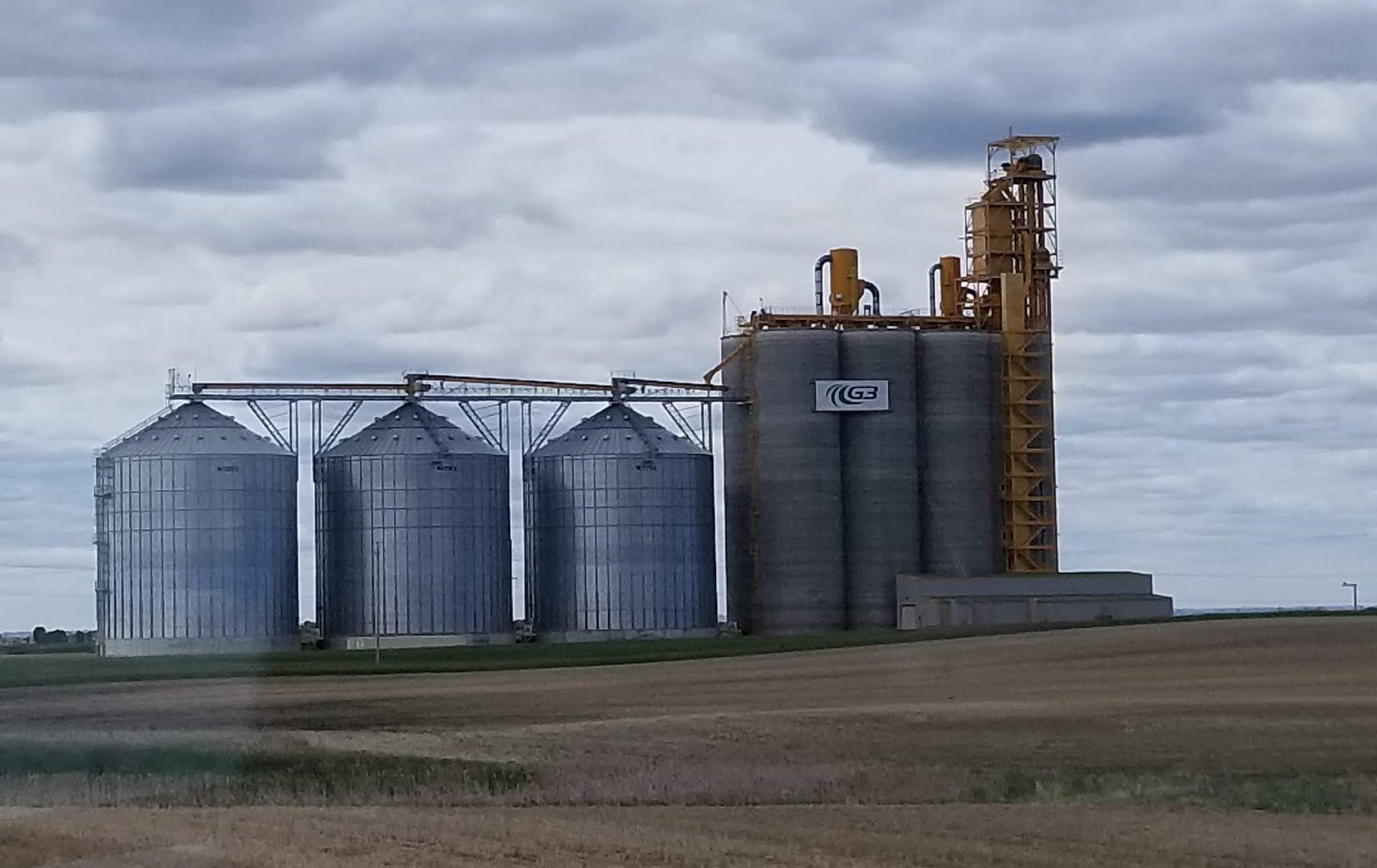
We have come to recognize the larger grain
elevators as they loom over the prairies. Then we saw a structure much bigger
than a grain elevator transfer station.
With the help of the sign, Potash Corp., we learned this was a potash
plant. A hill of waste product extended
beyond the plant. Potash is used 95% for
fertilizers and 5% for industrial, commercial use like soap. Where potassium is
deficient in the soil, potash fertilizer can fix the problem.
Potash in some of various mined and
manufactured salts that contain potassium in water soluble form. Before the
industrial age plant ashes were soaked in a pot of water. The word potassium is
derived from potash.


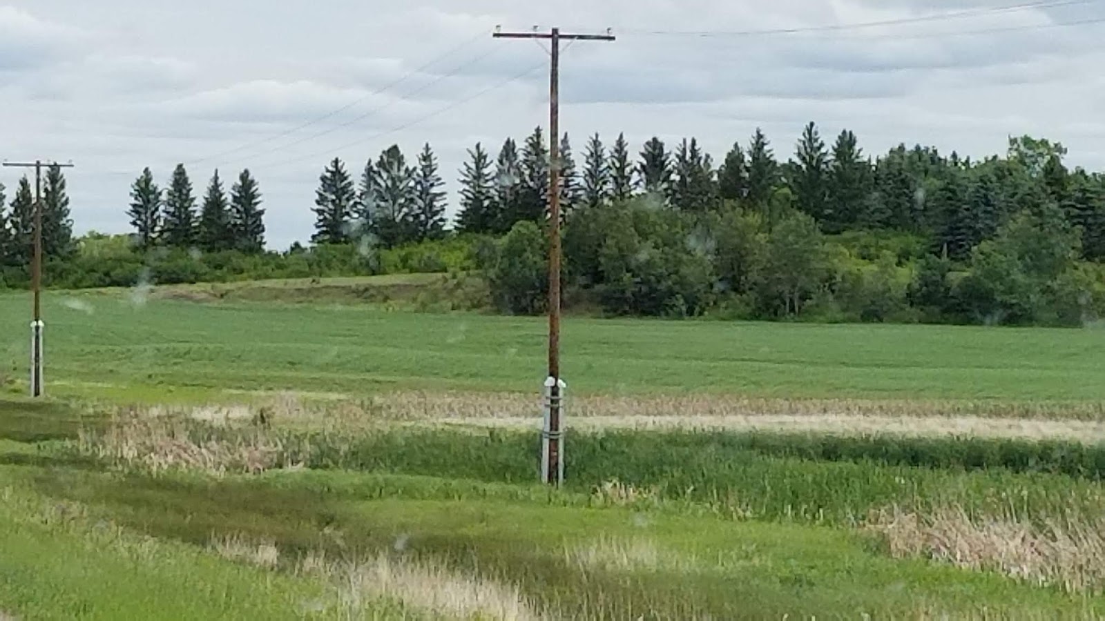

I have come to realize that the prairie
displays a beauty all its own. Rolling fields of green or gold lie in contrast
to darker shades of hunter and forest green trees, against a big, blue sky that
meets the fields at the horizon. Some trees stand in a line, possibly for wind
protection. Other trees form small
islands in the fields that the farmers plant around. Most of the trees and
shrubs are deciduous, but every so often conifers peek over the smaller
vegetation. Farm out-buildings are easy
to spot from the distance. The farm houses themselves sit hidden behind a
fortress of trees. A sense of serenity
and calmness can be found in the peacefulness of the prairie.


Even the rows of grain silos and oil tanks present a sense of order to the world.


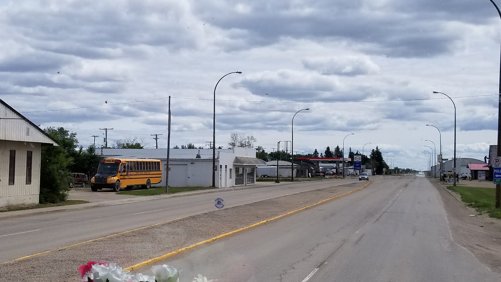

Lanigan represents many of the small towns
we passed as seen through our bug infested windows.


Between miles of fields, small communities
of people gather. Most
towns have less than 1,000 people and barely a blip on the map. If you blink, you might miss it. We passes through some with less than 200 people. Several of
these little towns advertise with small signs placed singly in row to tell what
amenities are available. One even had a
hotel sign saying it was open on Sundays.
We passed a town called
Kandahar. I didn’t know that Kandahar
existed in places other than Afghanistan.


At this point in the road, TC-16 turned left. This is what interstate intersections look like in this part of the country. No exit on or off ramps! No overpasses! Just a simple left turn. Straight ahead to Regina, turn left to Yorkton.

Signs began to show up regarding Quill Lake. A
quick glance to the right allowed me to spot several white American Pelicans
swimming in a nearby pond. Sorry….I
didn’t react fast enough for a photo. But I did catch this Great Blue Heron.
Quill Lake encompasses three
distinct lake wetlands: Quill Lake, Middle Lake and Little Quill Lake. The wetlands complex covers 245 square
miles. Quill Lake water is saline. The salinity varies according to the water
levels in the lake. This bird sanctuary provides
staging and breeding areas for the spring and fall migration of
shorebirds. The site qualifies as an
Important Bird Area for its global and national significance of migrating and
breeding populations of more than a dozen species.
The island located in Middle
Quill Lake has been designated provincial wildlife refuge for protecting
breeding colonies of American White Pelican and the Double Crested Cormorant.


The town of Wynyard, population 1,767 showed Quill Lake 2.4 miles up a dirt road. We passed through town deciding if we wanted to see Quill Lake. Yup! Gonna do it!

Of course we now need to turn our 65 feet of vehicles around. Derrille spotted a silo storage area big enough and turned us around. Look closely and you can see our tracks in the photo.
We got to town and ready to
turn, then OOPS! The sign didn’t say 2.4
km. It was 24 km down a narrow dirt road.
A trip down the road, and a visit to the center meant at least a couple
of hours added to an already long travel day. We choose to pass; except we are
now going the wrong direction.
Derrille finds a wide
intersection and negotiates a beautiful U-turn.
A&W restaurants are found
all over Canada. Wynyard’s A&W
appears to be fairly new. We found a
place to park the rig in front of a vacant business and walked back. YUM!
We can’t remember the last time we ate at an A&W, but we really
enjoyed the food and the cold, frosty, root beer!


I wish they were still all over in the states. I also liked their commitment to ecology.

14206 142323

Little towns dot the highway all along. Ukrainian culture thrives in this area. The town of Theodore had these Ukrainian church and cemetery. We saw a sign advertising Ukrainian dancers.


The city of Yorkton looked like many of the other little towns. On the way we
saw a Flying J station. No fancy truck
stop, just the gas pumps.

Road Work!
The York Lake Regional Park a little south of Yorkton, our destination, not as nice as expected. The office had assured me that they could accommodate us.
The York Lake Regional Park a little south of Yorkton, our destination, not as nice as expected. The office had assured me that they could accommodate us.
We found the turn off to the
park with a NO TRUCKS sign. So we didn’t turn. We went further down the road
expecting another entrance. Wrong again!
At another intersection with a major road, Derrille made another U-turn. We called for directions, and the man said to
just disregard the No Trucks sign. So we
ventured down the dirt and paved road.


Some nice homes set back from the road on
their acreage. We arrived at the park.
The man I had talked too n the
phone, met us as we entered the park. He
wasn’t sure we could clear the ironwork entrance over the road to the sites. We did it easily.
Sites were iffy. He directed us to site 1. Can you imagine a grassy knoll? Not a flat space anywhere! The tight turn in put us in front of a small building. So we had to unhook to back up. I had been assured there would be no problems when I made the reservation. I received no good vibes now! So while Derrille and the man were literally discussing the lay of the land, I called the other RV Park in town. The friendly owner assured me he had room for us.
Sites were iffy. He directed us to site 1. Can you imagine a grassy knoll? Not a flat space anywhere! The tight turn in put us in front of a small building. So we had to unhook to back up. I had been assured there would be no problems when I made the reservation. I received no good vibes now! So while Derrille and the man were literally discussing the lay of the land, I called the other RV Park in town. The friendly owner assured me he had room for us.
Driving separately we left. I
led the way and missed the turn to TC-16. This necessitated yet another
U-turn. My phone gave me directions to
the park, and I made another mistake and trusted it. BAD IDEA! Instead of
taking us to the signal on a paved road and turning at the signal, as Derrille
had suggested, it took us down dusty, rocky dirt roads. A giant pothole covered
both lanes and demanded severe caution to bump across it. Needless to say
Derrille was not happy about my road choice, and neither was I. We do know better than trust GPS. We did arrive at the City of Yorkton
Campground with its wide road and wide sites. I didn’t take any photos. We just sat and recouped after a very long
day.
No comments:
Post a Comment