# 13 Winnipeg: We spent one day exploring the Forks area and a second day driving around because we couldn't get on the tour. So I have combined the two days as I describe an area. The Canada Museum for Human Rights will have its own blog.

It is little surprise that most Canadians
that are out and about appear very fit. Parks pop up everywhere! The number of
accessible trails for walking, jogging, and biking encourages people to be
active. I was thinking that good weather
brought people out like it does in the Pacific Northwest, but in winter they
apparently come out to skate, ski and ski mobile.


Saw a group of moms with several of these
four seater strollers. Almost missed any
photo at all. I was just amazed by the parade.


City trails appear on all tourist maps of
Winnipeg. One pamphlet called the LOOP shows a 9.5 km (5.5 miles) walking tour
around downtown Winnipeg. It includes
crossing bridges to visit the east bank of the river. Approximate time involved
is about 3.5 hours. We drove.

The Assiniboine River flows into the north
flowing Red River here in downtown Winnipeg.
The Red River originates in the States and is one of the few rivers that
flow north. The rivers meet at an angle
to great a fork in the banks. The Forks
became a meeting place over the years. Today the riverside complex is
considered the tourist center at the heart of Winnipeg.


We started our day finding a parking place
at The Forks. Parking fees are paid at a
central kiosk, where you get a ticket to put on your dashboard. Parking costs $2 per hour.

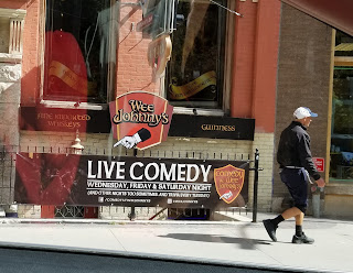
The next day in the Exchange Area we did see a parking officer at work. We parked next to the Johnston Terminal. The entire area was once all railroad property, and a terminal still sits off to the side.

The first things that caught our attention looked like the Alpine horns used in Ricola ads. Long tubes of brass sculpture with flared ends ring a stone brick bowl.


A
stone path curves down to the center area.


The official name of this board is the
Oodena Celebration Circle. The reader
boards liken it to the Celestial Calendar in China, the Moose Mountain Medicine
Wheel in Saskatchewan, and Stonehenge in England and the Pecked Calendric
Symbol in Mexico. The circle creators consider a sacred gathering and
celebrating place….a monument to Cultural and Natural forces.


Stationed around the circle are plaques
representing different constellations.
The brass sculptures with circles on the ends provide a way to view the
heavens on certain days of the year when the stars align with the brass
circles. Had we been in town we could
have aligned one with the summer solstice.


A path continues into the park and up to a
bridge. On our way an exhibit called “On
the Docks” shows architectural plans and info about unique structures built on
the docks around the world. I spotted
the Space Needle in Seattle with the Big Wheel as one of the projects on the docks.


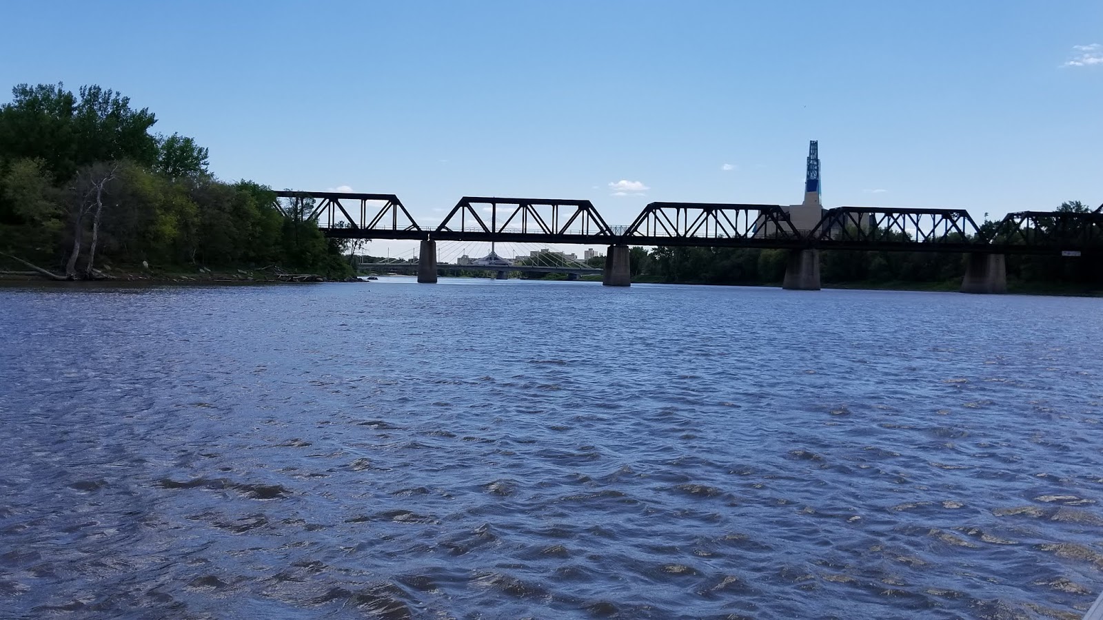
This green bridge is a walking path in the summer. In the winter when it snows, they ice it for skating on the paths. Today we stood and looked down at The Forks riverfront. We spotted boat tours and headed down for a ride.


Nick captained our boat. Here he complies
with safety regulations and shows us the life preserver. He is a university student majoring in
education. He hopes to high school sciences.
Judging from his tour guide performance, he possesses skills to be a
successful teacher.


As we head up the Assiniboine River, I am
again amazed by the number of people using the river walk. Of course it is a
beautiful day to be out. Bicycles are a
major form of warm weather transportation in Winnipeg.


Nick stopped to show us the water markers
painted on a bridge support. The blue
line indicates this river’s water level every spring! Notice it is currently a lot higher than we
are! The river rises with snow melt and rain. It floods this area with water,
mud and silt. About May the city sends workers to begin cleaning up and finding
the river walking path. It takes about a month to clean it up.

We saw workers by the legislative building still pushing mud back into the river. Nick mentioned that just pushing the mud back in the river will eventually cause another problem. The two lines above the blue line indicate exceptionally high flood years. Can’t remember the date!

We saw workers by the legislative building still pushing mud back into the river. Nick mentioned that just pushing the mud back in the river will eventually cause another problem. The two lines above the blue line indicate exceptionally high flood years. Can’t remember the date!

The Manitoba Legislative Building creates a
perfect photo op from the river. A
bronze stature of Louis Riel stands at the top of the stairs. We heard about
him in Saskatchewan too. Riel sparks controversy. Some Canadians think of him
as a hero; others believe he was a traitor.
Both sides do agree that he is an important figure in Canadian History.
The Golden Boy shining on the top of the
dome actually stands 17 feet high. He was commissioned from Europe, but on his
way here war broke out. The ship in which he sat in the hold was put into use
as a troop ship. The Golden Boy made
several trips across the Atlantic before arriving at Manitoba.

The light in the capitol dome indicates that the legislature is in session.


The light in the capitol dome indicates that the legislature is in session.


Nick took us back passed the dock and out into the Red River. Another photo op shows the Canadian Museum for Human Rights and the Espanade Riel pedestrian bridge.

The
round structure on the bridge houses the Mon Ami Louis French restaurant. Next
to this gorgeous bridge, the Provencher Bridge moves vehicles across the river
toward the St. Boniface area.

The next day we came back into town on the
Provencher Bridge, with the restaurant to the left and the Human Rights museum
on the right.
135425


 |
| From the boat ride |


The remains of St. Boniface Cathedral Basilica built in 1908 faced the Red River. In 1968 a fire destroyed the church. The big empty circle originally housed a stain glass window. The force from the fire blew the window out and some pieces landed in the river.


These memorial markers are in the wall that
was left.


The
current St. Boniface church incorporated some of the remaining walls into the
new structure.


A
cemetery occupies the grounds between the Cathedral and the river. Beautiful
headstones fill the area. I had hoped to
view the interior of the new church; however the vestibule was full of people.
Then we noticed the hearse and the casket.


We did find these two signs a bit interesting.


We did find these two signs a bit interesting.


A group of costumed interpreters were
acting for this group of children. They cavorted through and around the grave
stones. We returned to the car and drove around the streets.


Student housing looks the same at any small
college or university.

 Our boat tour then moved to the Exchange
District. The old docks remain from a time when this was a busy shipping
port. Goods were transported to and from
the port via railroad. The massive exchange of goods led town leaders to
anticipate growth as a transcontinental shipping leader. However, then the Panama Canal opened and
goods could be shipped to the Western side of the continent.
Our boat tour then moved to the Exchange
District. The old docks remain from a time when this was a busy shipping
port. Goods were transported to and from
the port via railroad. The massive exchange of goods led town leaders to
anticipate growth as a transcontinental shipping leader. However, then the Panama Canal opened and
goods could be shipped to the Western side of the continent.


The destiny of these old docks and prime
riverfront is being discussed by the city. The Exchange District still reflects
the architecture of old Chicago in the early 1900. Movies are filmed here to take advantage of
the authentic buildings.


We
revisited this district on day two and got some photos of the old buildings and a park by the river.


The diversity in Winnipeg shows in many areas.


The remains of old Fort Gibraltar sits
overlooking the Red River. We drove up
buy chose not to visit. It was built in 1810 and today is home to Festival du
Voyageur in winter and costumed interpreters bringing the fur trade to life
May-August.


These houses were in the Fort Gibraltar
neighborhood.


Nick our boat pilot really liked the view
of downtown Winnipeg from this spot in the river.


We returned up the Red River. From this angle
we saw “the fork” with Assiniboine River.


As we returned to the dock we saw the area of the river walk staked out by the Canadian Geese.
A family of Canadian geese and another of
Mallard ducks hung out around the boat dock.


A circular walkway curves upward from the boat dock to the top of the bluff. This area was once an archaeological dig.


Plaques inset into the wall record what was found at the various levels. The blue tile above the plaques and reader boards shows the water level at one time.


Several businesses call The Forks home. The Johnston Terminal today house would delight you shoppers with its three floors of eclectic shops.


The
Commons and old railroad building supports a variety of shops, restaurants and
food courts. Lots of places for foodies
and vegetarians! We found Danny’s met our dining needs.

The area stressed ecology and keeps the
area litter free with lots of garbage and recycling bins. I wish Americans had
the same amount of pride in keeping their country free of litter.
A fancy looking hotel and a children’s
museum also call the complex home.
We then went over a block and toured the Canadian Museum for Human Rights. I chose to put it on its own blog.
We then went over a block and toured the Canadian Museum for Human Rights. I chose to put it on its own blog.
A large tourist information center at The Forks helps
people find what to do and see in Winnipeg. It provides information on
tours. We went in on Day 2 to find the
city Trolley Tour. The tour doesn’t run
on Monday so we arrived early on Tuesday. The lady told me the tours were all
sold out for that day. Apparently people went on online for
tickets. Nothing in the literature said to do that. So since we were leaving
the next day, we drove ourselves around town, and that's why I just incorporated the two days together.


This is the Canadian Mint. We chose not to visit it, but the grounds looked lovely. It might be interesting to see the beautiful Canadian money is made.


Check out the signs on this cab.


We ended this day with another delicious A&W experience.
No comments:
Post a Comment