Update 19: Moncton, NB August 4-7, 2010
The rain pelted against the RV yet again as we entered New Brunswick. This is our third entry to the province during a rain storm. The good size city of Moncton lies in the southeast corner of the province. The City Camp RV resort placed us in the 50 amp section of the park. Yea!


Several extended stay folks live close by. The people across the street own a 36 foot RV with about 50 feet of deck raised to the level of the RV door. Patio furniture, plants, a screened porch tent and a huge silver BBQ fill the deck. They apparently own four other vehicles too counting the cars and trucks parked within their space. The next site over belongs to the previous owners. Their new million dollars Prevost with matching trailer to haul the Mercedes fills the pull through. Next to the RV and a grass patch sits a brick casita. As near as we can tell the casita includes a kitchen, sitting room, fireplace and/or woodstove. The fence in the photo surrounds a duck pond. The family behind us fenced their site for two large dogs.
We set up the RVs and went to Wal-mart for photo processing and to a laundromat. The guys found a Supercuts and I went there later. During my haircut I discovered when to put their names on the list the two fun loving guys wrote down Jay and Jay 2.
To our delight we also found a St. Hubert's Chicken restaurant just like we found in Quebec. YUM!
About an hour southwest of Moncton, Hopewell Cape allows visitors to walk on the sea floor three hours before and after low tide to view the Hopewell Rocks. At times other than this the beach is under about 10 feet of water. Although the ticket seller told us the trail down was flat, it wasn't. (hmmm didn't we hear that just recently?) The 15-20 minute steep descent from the visitor center on the cliff to the access stairs above the beach, could be considered flat, as in even,. ..but the grade headed down steadily. Metal scaffolding at the beach entry point encloses the six narrow flights of open metal stairs and their metal grate landings. Two people at a time can be on the same step, but it's tight. The stairs look like a fire escaped wrapped around itself. A steady flow of visitors some with their dogs travel up and down the stairway.


Two kinds of rock make up these cliffs. Hard conglomerate rock results from stones and pebbles being cemented together by hardened silt. Conglomerate rock forms the top layer os rock. The lower layer of sandstone results when compressed sand turns to stone. As the 30-40+ foot tides rush in and out twice a day the soft sandstone erodes at a faster pace than the conglomerate. This erosion process creates the vision called the Hopewell Rocks.

Some of the rocks resemble the heavy stemmed Spanish glass goblets popular in the late sixties and early seventies. Others look like big stone trees from a child's drawing. Trees and vegetation sprout from the tops of the stone creations of nature.
The park calls the creations, "Flower Pots".
Seaweed clings to the lower edges of the sandstone waiting for the incoming tide. This beach offers two kinds of seaweed; one of which is commercially used around the world. The green seaweed shows how high the tide will rise.
A specific kind of mud shrimp also calls this beach home. The ranger told us migrating sandpipers will stop here just for the mud shrimp. 20,000 birds at a time have been seen lifting off the beach to fly on to South America. The beach itself is rocky near the cliff.
Larger pieces of rock appear as the tide recedes, until the mud flats are exposed. One beach area is nothing but mud when the tide goes out. We walked about a mile or so along the rocky beach for a couple of hours.
Then we returned to the car and chose a picnic table near the parking lot to eat lunch. Before leaving we returned to look at the incoming tide.
We continued to follow the coastline in the rain and the fog. A small park called "The Shipyard" caught our attention, so we stopped to learn a bit about its history. Further down the road we stopped by a marsh and read that information.
By the time we arrived at Cape Enrage the dense, damp fog hung heavily over the beach. The fog horn bleated out its mournful call. The guys walked down to see if any tide pools existed as the ranger said. They found some, but unlike the tide pools at home, these were sparsely inhabited. The seaweed marking the high water line showed a similar 10 foot rise from its current location. Two rocky ledges sat above that line. On the first ledge above the seaweed a bare tree trunk and other logs lay randomly on the rocks, telling us that the water came up there too. The next ledge up was the parking lot. Flat, round, smooth rocks covered every inch of surface from the parking lot to the sea.


From here to drove to Alma the gateway to the Fundy National Park. We looked at the visitor center and drove part way into the park before returning to Alma. Here the rising tide climbs a foot every seven minutes and up to 39 feet in 6 hours and 13 minutes. In the harbor good looking fishing boats sat propped up in the mud awaiting the incoming tide and water in which to float again.
We returned to Hopewell Rocks and watched the water's advance. Lynn, Jay and Derrille trekked down to the beach again. I waited on top of the cliff.
The tide had almost reached the cliffs covering the area we had walked on earlier in the day. The cycle of today's tide was nearly complete by the time of our return.
This is the beach that was bare earlier in the day. The highest tides in the world of about 54 feet occur just a little north of this cape. The wonders of nature amaze us!
The northeast corner of New Brunswick remains home to the Acadian people. During the 1755 deportation some Acadians hid and later settled here. The Acadian Trail takes visitors through their communities. We began our tour in Shediac, a very upscale, quaint, clean seaside resort community. Their shops and restaurants looked inviting. Driving north from there we viewed modern, beautiful, expensive homes with unobstructed views of the ocean. Colorful well tended gardens and/or ponds graced some of these estates. The further from Sediac we drove, the more modest the neighborhood became.
Wildflowers brightened the meadows and road shoulders with yellow, orchid and white blossoms. The colors showed most brilliantly in places where one color appeared in a mass array.


At the end of driveways, close to the road, many home have positioned a wooden container. The average size is approximately 3' long x 2' high x2'wide. The shape and construction materials varied. Fancy, new bins resembled a treasure chest or octagon shape made of wooden slats. The most popular style remained the basic rectangle. The plywood boxes usually were covered with siding or just painted. Some home used black or white metal boxes. One home had a heavy plastic black keg shape. All had hinged lids that opened from the top. After spotting a few Waste Management dark green plastic cans, we discovered the boxes are for garbage put in clear plastic trash bags and deposited into the containers at the driveway edge for pick up by the garbage company. I found the use of the clear plastic bags interesting since we have been given those in a few campgrounds, and it was how garbage was collected in downtown Montreal.
Approaching Boutouche, modest homes sat on very large lots and stretched out over the land. I found it interesting to see mid to large size RVs parked closed to nearly every home. Perhaps we were viewing the summer homes of people who enjoyed summer on the Atlantic coast and winter somewhere warmer...like Florida. Just a few miles further the number of vacation cabin rentals and RV parks suggests that summer visitors help support his region. One point of rich, green land made us think it was a park until we passed by a bit further and noticed bales of hay around one side. This was a single home on a beautiful point of land.
The Acadia Trail traveled the usual bumpy roads and added in several old, one-lane, wooden bridges
Near the town of Bouctouche, Lynn, Jay and Derrille braved the heat and humidity to walk on the La Dune de Bouctouche.
A slender sand spit slides out into the bay. A boardwalk allows visitors to venture 2 km/1.25 miles onto the spit. Fencing along the boardwalk protects the fragile vegetation needed to save the dunes. Only 2000 people a day can visit the boardwalk. After that the area is closed to visitors.


The next major city on the route, Richibucto, seems like a good for a bathroom stop, since conveniences are difficult to find in the Maritimes. According to the map, Richibucto ranked among the biggest town along this part of the Acadia Trail. Someone suggested, "Tim Horton's!" Laughter erupted at the thought of finding the famous donut shop along this road devoid of almost any businesses at all. More laughter erupts as we round the curve and there it is.....Tim Horton's right in front of us! We pull in and laugh some more at the ever present line up for the drive through. Here on the edge of the Atlantic in an obscure village, Tim Horton's drive through has a 12 car waiting line! Canadians love their Timmy Horton's!

The French influence becomes stronger the further north we travel. Mailboxes reflect names we've come to recognize as Acadian family names. The Acadian flag flies in front yards or hangs from the decks. Catholic churches appear with greater frequency like in PEI. Life size crosses and small grottos of Mary stand by the road or in a home garden. Many houses sport those colorful paint jobs I've noted before.
The road takes us through another National Park and out to a remote section. Fortunately we didn't have to pay the day use fee since we were just "passing through". Many roads have taken us through parks, and we have learned to let them know we are not using the park except to drive through. The openness of the land to the sea, the number of campgrounds with "beach access" offers the feel of a typical "beach community".
In St.Louis de Kent, the largest Acadian Flag we've ever seen flies high over the city.
Just before getting to Miramichi, we discovered a spit of land with a dock attached. Three large sailboats were anchored to the dock. The sun shone brightly while a stiff wind blew. We chose this as our lunch site for today.
The large town of Miramichi resulted when the smaller villages of Newcastle, Chatham, and 8 other villages and districts came together. From the description in the tour book, we expected a quaint town along the water. A lovely little park did exist next to the harbor, but we never found a tourist area with shops and restaurants. We did find Tim Horton's. :) Although looking again at the map, we were probably on the wrong side of the river.
From Miramichi north toward Tracadie-Sheila, the next town of any size, the countryside no longer showed bilingual signs. New Brunswick and Ontario are considered bi-lingual and offer all signage with English on top and French on the bottom. Quebec begrudgingly offers both with the French on top and the English below. However, in this corner of the world everything is French language only: street signs, store signs, billboards, reader boards, etc. The Acadians feel strongly about maintaining their language and culture.
Acadians love festivals! At this time they were celebrating a 225th year of something. I think it was their return to the Maritimes, but I'm not sure. Nearly every house in Tracadie-Sheila and many out of town displayed the Acadian colors.
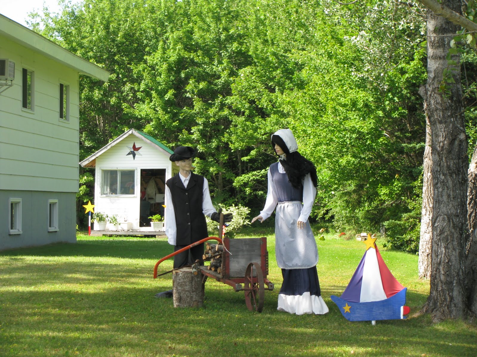
The Acadian flag: red, white, and blue with a yellow star flew in the wind. Smaller flags decorated gardens. Big flags hung from decks and balconies. Strings of red-white-blue plastic pennants swung across yards and streets. A yellow mum like flower (sometimes plastic) hung with other decorations. Banners stood proudly in yards displaying the Acadian family names of household members. Tracadie-Sheila was the end to our day, and we headed home. I think to experience the Acadian culture: visitors would do well to plan attending several of their events or festivals.
Next stop: St. Martin, New Brunswick


 Some of the rocks resemble the heavy stemmed Spanish glass goblets popular in the late sixties and early seventies. Others look like big stone trees from a child's drawing. Trees and vegetation sprout from the tops of the stone creations of nature.


No comments:
Post a Comment