Update 20: St. Martins, New Brunswick August 7-12, 2010

 Oh, how we loved St. Martin's! Getting to St. Martin's presented an adventure in itself. The Woodall's Camping Directory and Big Rig Book gave dueling advice on entry to St. Martin's a small village east of St. John's. The Big Rig book added 75 miles by using the freeway and driving nearly into St. John's first. Trusting Woodall's we went in on East Hwy.111. Like most of the roads in severe winter regions Hwy.111 needed repair. We bumped and bumped along narrow, roughly patched roads for 34 miles. As we crested a hill just before St. Martin's, the road seemingly dropped away. A 17% downgrade led us to a tight left turn onto Main Street and then to Century Farms Camping Resort. However we did decide later that this was the better way into town.
Our escort led us to two roomy sites facing the Bay of Fundy. We looked directly at a headland of red rock topped with green trees. The headland jutted into the bay, while the tides eroded two very large caves in the side we were watching. WOW!


The beach below the steep gravel incline is very flat and goes out at least one quarter mile or more. The mud is gooey and can suck your feet in. We learned across the bay in Nova Scotia that the tide comes in at 8 km/ 4.8 miles an hour, so if you are out there you need to maintain a fast jog in to stay ahead of the water. People wade in the water, but swimming is discouraged because of the strong tides and the rate at which they roll across the mud flats..


"Zip" is a bit of a misnomer, it took about 15 minutes or more in each section to move the entire group through before going on to the next section. The activity entertained us.


Monday we considered touring the Fundy Trail before returning to St. John's for Derrille's jet boat ride. The guys decided to walk the first trail. The trail went down steeply with roots and vegetation encroaching on the trail. Lynn and I decided to wait. I noticed the trail seemed to go quite a ways. So we waited. Then a car pulled up next to us and asked if we were Lynn and Dorothy. They told us that a couple of guys down the road wanted us to bring the car and pick them up. We laughed....this is not a first time occurrence. At that point we decided the trail needed more time than we had, and we headed for St. John's.


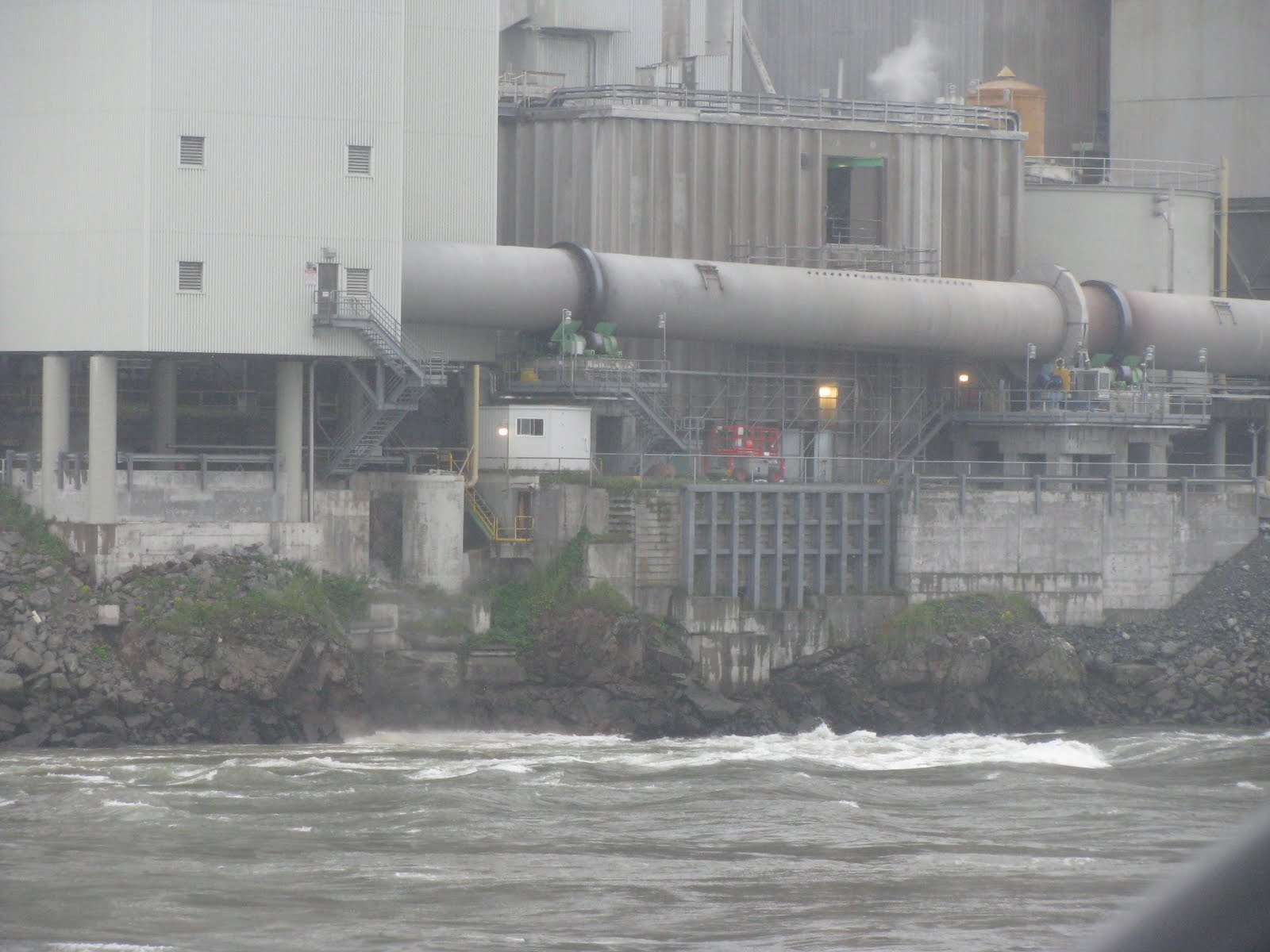

Within 20 minutes the rapids increased in number. By 30 minutes they have increased in size and intensity.....from calm again to raging rapids.
The rapids are created when the incoming tide meets the outgoing river current. A ledge of rock lies just west of the paper plant and about 35 feet below the surface of the water. The depth of the water in this part of the river is recorded at about 80 feet. We thought the rapids were rolling over boulders in the the river. Not so. The rapids form when the tide and rier currents meet. The incoming tide puts the rapids west of the paper plant. The outgoing tide creates rapids in front of the plant. As with most water events, the tides are even more severe on full and new moons. We spent a long time looking at this phenomenon over the three day span. We observed incoming, outgoing, and slack tides. Fascinating!!


A veil of fog rested just inches above the flat smooth river surface. This time the plant waste trickle moved toward the sea with the outgoing tide. The fog began to lift a few feet. The trickle from the paper plant stopped! For those 10 minutes or so the tide goes slack and nothing moves. It was high slack tide and nothing rippled.

 The fog continued to lift slowly. Two seals played in the water. We walked to the cove where the kayaks battled the water on Sunday. At first it was also flat. Then small whirlpools bubbled up, the current around the island edges begin to run faster inland, up river. The seaweed covered rocks near the shore disappeared under the water.

Ripples appear in the mainstream. White water grew with each few minutes. The ocean tide flowed west driving over and through the river current flowing east. Now about 20 minutes after high slack tide, the waves turn into white water rapids flowing west of the paper plant. The fog has cleared. The sun shines brightly. Seals ride the ocean current to the rapids and dive for food. Cormorants fly to midstream, float with the tide too, and dive along the way for food. The area I call Kayak Cove now roils as the two currents meet and fight for dominance. Within an hour the water went from smooth, calm, and flat, to strong westward flowing rapids. While waiting for the rapids to form we visualized yesterday's rapids on the outgoing tide as they flowed east in front of the paper plant. None of us anticipated that the when the rapids reversed, that they would reverse where they developed too, and flow just west of the paper plant. We spent about two full hours watching the total change.What a marvelous part of nature to observe!


 Next we toured the visitor's center and took in their short film about the history of the trail and the logging industry in the area. Derrille and Jay took the trail from the visitor's center down to the Salmon River. Ruins of the old logging camp remains where the river meets the Bay of Fundy. The fog had lifted by now so we returned to the end of the road and started again, this time able to see the scenery and the bay.
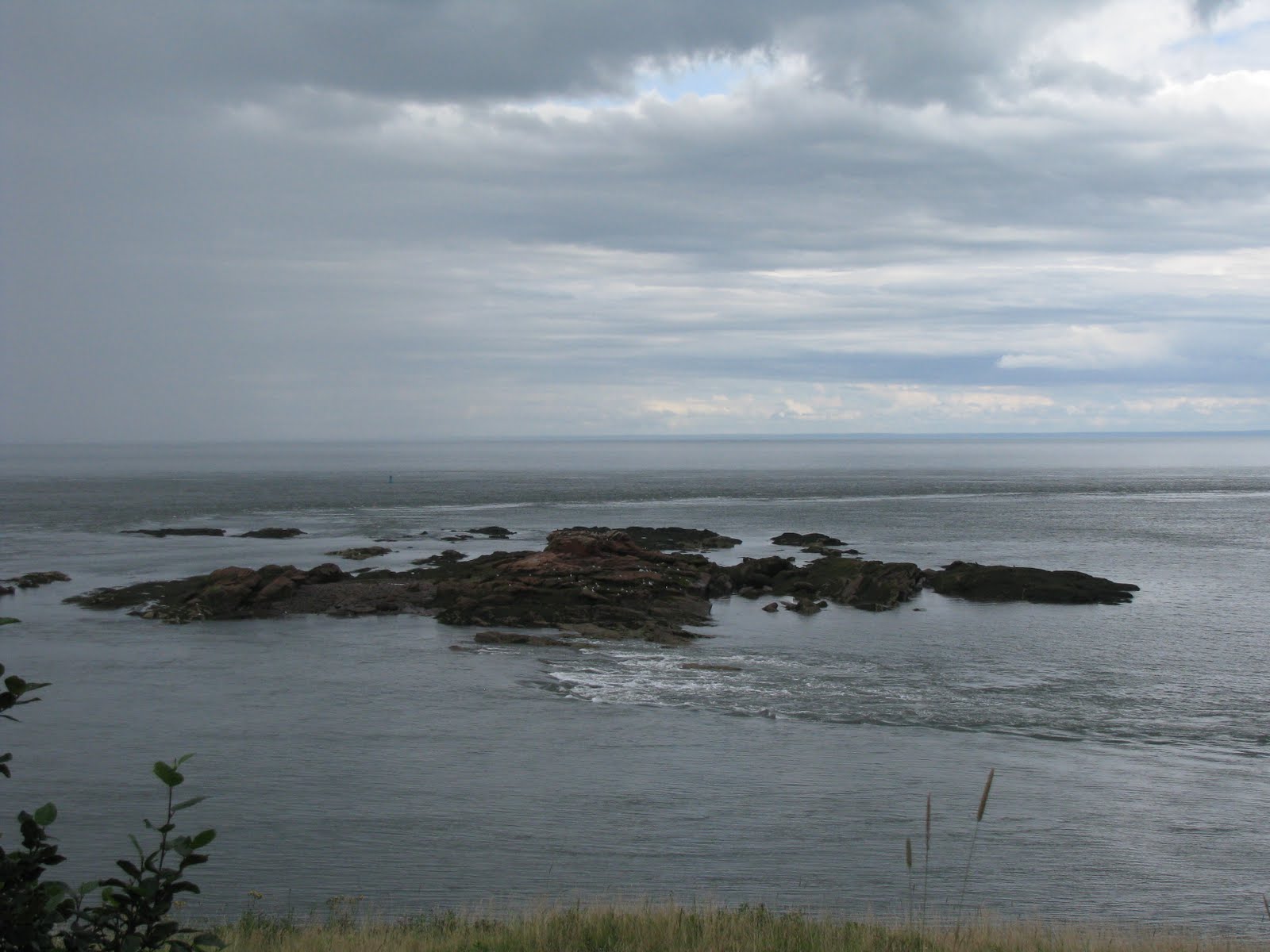
 We stopped at lookouts and thoroughly appreciated the beauty of the blue sea, sandy beaches, rugged rock and green trees. We hiked into see the waterfall and spent about 3.5 to 4 hours exploring the park.
 Only a couple of kilometers separate the park entrance from St. Martin's. We crossed over the single lane old wooden covered bridge and noted the tide was well on its way out.

For comparison, here are the same places during high tide.


This is looking across the little harbor from the covered bridge.


Around the next corner in the next cove people were scouring the cove now empty of water and exploring the caves. We donned our water shoes and did the same.

To access the caves, visitors need to walk through the ankle deep creek. The cave absorbed the light from my camera and prevented a good photo of its interior.


As the tide continued its outward journey we could climb seaweed blanketed boulders carefully and get around the headland we see from the campground. There on the other side the ocean had carved out U-shaped box canyon where the sea was the only way out. Additional caves are being eroded there also.

 Should someone be foolish enough to get caught with an incoming tide, a knotted emergency escape rope will provide an access out.
 This is a view looking out from the back of the canyon toward the sea.


We walked around the seaweed hills to return to the car.


We also took some photo ops. Note the level of the seaweed indicating the water level at high tide.


Jay felt the need to release any dammed up streams so they too could flow out. We returned home feeling very satisfied with the day's discoveries.

To give you a sense of how far out we are, the bright white just below the trees is a camper. The Stauss car is parked next to it.
Out last day in St. Martin's we hung out at the RVs enjoying the sun, the sea and the perfect temperature.

The rocks in the water allowed visitors to experience how the changing tides create rapids. Just during the time we were there the tide went out this fast. The scenery here was exceptional.
Following the advice of someone we met, I followed the trail around the lighthouse and up the hill in search of blueberries. I didn't know that wild blueberries grow like ground cover. Most of the berries were extremely small. It took some searching to find anything near a descent size. Later I made us a strange cobbler, that didn't turn out as expected, but tasted good. I said good-by to St. Martin's reluctantly.
Next: Back in the states....Maine
No comments:
Post a Comment